South Africa Roadtrip
This trip took place back in September 2016. It was an epic adventure, taking in some of South Africa's most famous sites for history, nature, geology and wildlife. This is a photographic record of the places I went, which may inspire your next South Africa itinerary. Note that information may be outdated, so be sure to do your own research.
AFRICATRAVELGEOLOGY
Table of Contents
South Africa Road Trip - Part 1: Cape Town and the Coastal Route to Hermanus
South Africa Road Trip - Part 2: From Hermanus to Knysna via Route 62
South Africa Road Trip - Part 3: 35th IGC Field Trip through the eastern Bushveld Complex, Mpumalanga Drakensberg Escarpment and Kruger National Park
South Africa Roadtrip - Part 1:
Cape Town and the Coastal Route to Hermanus
When I was in Cape Town, I rented a car which I planned to take on a roadtrip. I hadn't really decided where I was going to go, but I had bought these geological guide books at the Geological Congress suggesting some unique places across South Africa, so I thought I'd try to tick some of those places off my list of places to see.
I wanted to go to Hermanus to try to see whales from the coast, which the town is famous for. I also wanted to drive Route 62, where many of the geological highlights are to be found. I then wanted to see what the famous "Garden Route" was all about, a renowned 200 km scenic coastal stretch in South Africa’s Western Cape, extending from Mossel Bay to Stormsrivier.
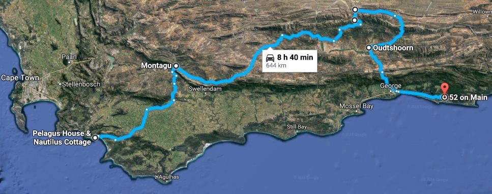
The first part of my journey was by train to Boulder's Beach, but I then picked up the car and went on my grand journey! The first part of the route is shown below.
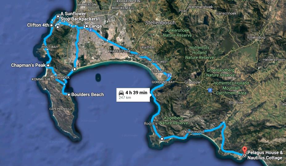

Accommodation along Part 1 of the South Africa Road Trip
A Sunflower Stop Backpackers - a cheap place to stay in a safe neighbourhood in Cape Town with en-suite bedrooms and dorms with communal facilities.
Pelagus Guest House in Hermanus near the coast. Very nice place but I felt out of place in this house that looks like the home of some imperial master.
Cape Town
I spent 7 days in Cape Town, where I stayed at a hostel called A Sunflower Stop in Greenpoint. It is a really nice location smack in the middle between the centre, Seapoint and the Waterfront commercial areas, about 700 meters walk from a SPAR supermarket, alcohol store and restaurants. The hostel itself was nice, with lovely communal kitchen area, comfy beds and for the most part clean communal showers and toilets, but some of the staff was pretty reckless and far from service oriented. The dorms are a lot more quiet than what you’d expect in a hostel, which is good cause you can actually get a good night’s sleep.
I was in Cape Town for the International Geological Congress, with two courses during the weekend and 5 days of congress where speakers from all across the world came to speak about what they had been working on, anything between historical geology and geoscience education to geotechnical engineering and ore forming processes. Because of that, the stuff I got done in those 7 days was a bit limited, but what I did manage to do while in Cape Town was to go up Table Mountain, visit the Bo Kaap neighborhood, Clifton beach, Boulders beach, Chapman’s Peak and Langa township.
Cape Town is an absolutely lovely city, very modern, clean and it definitely doesn’t feel unsafe (back in 2016 at least), despite the bad rep. I would still not really recommend people to be walking in dark, lonely places at night. The city has endless restaurants with great food and lots of places to stay. I has breakfast, lunch and coffee included in the congress fees, but I had the opportunity to try some of the local restaurants at night. Sometimes I’d just go for simple fast food like KFC or Burger King, but TRUST ME, that is the least tasty stuff you get in all of Cape Town – even if KFC is tasty in your city, IT IS NOT in South Africa. And talking about “fast food” … those are in fact the restaurants that will take the longest to serve you! So even though the other restaurants feel unfamiliar, STAY AWAY from the known !! I’m telling you! Because food (excluding American fast food chains) is just SO GOOD in South Africa!
Restaurants in Cape Town
I tried a few places in town but I have no idea whether they still exist, and if they do, if they're still any good:
Rocomamas: A very popular burger place, it serves pretty good burgers, but being very much of a burger enthusiast, I didn’t think their burgers were anything to get too excited about, but the prices are OK.
Karibu: A South African restaurant located at the Waterfront mall. It’s a lovely place with nice decor and friendly staff, nice selection of South African wines but it’s a bit pricey and I was a bit disappointed with my Lion’s Head braai (not an actual lion but a mix of boerewors, lamb chop and a rump steak), as the steak was totally overcooked and chewy. If you’re looking for South African food, tourists also seem to like Mama Africa.
El Burro: The most authentic Mexican restaurant I’ve been to since Mexico. Their tacos are true, authentic corn tortillas, not the sort of rubbish you get at the supermarket. I had taquitos for startes and the pork carnitas for mains and oh my!! Delicious! Their Churros dessert is also really tasty. The decor is very cool and so is the balcony where you can sit and eat and look over the stadium and Greenpoint. This place is immensely popular so you may want to consider booking a table if going there on a Friday or Saturday night.
Hudsons Burger Joint: In Iceland we used to have this AMAZING burger place called Roadhouse with legendary burgers and I thought, after trying many different places across the globe that I’d never find any place as good, but Hudsons just might happen to be as good if not better than Roadhouse! They also make their own beer, too, which is very cool! It is also an enormously popular place, and definitely for a reason! And surprisingly enough, they also had salads that actually sounded really, really nice. I didn’t get to try them though but I did try the Poppa Trunks Reloaded burger (beef, cheddar, feta, bacon jam and chilli popper) and it was absolutely legendary! YUM!
Public transport in Cape Town
In Cape Town there’s a very well functional public transport system, unlike Johannesburg (in 2016), which is still to this day a big mystery to me. But then again, I’m a village girl – grew up in a village of 650 people, so finding my way through massive, chaotic cities is not my cup of tea unless the transportation system is particularly well organized, as it is in Cape Town. It’s very much idiot proof! I mostly used the local buses while there, which have lots of stops across the city. The main hubs of changing buses were Adderley and Civic Centre stations.
To get from the airport to the city, there was a city bus that took you to Civic Center for 90 rand, where you change buses or take a taxi from there. The point of departure was from the small glass building that you'd see right in front of you as soon as you walk out of the airport terminal. If things are still the way they were, once at Civic Center you would be best to purchase the electronic transport card and then load the card with money (in my case 100 rand for pay-as-you-go that lasted me 1 week in 2016). Also, if you have that transport card, you would get to travel between the airport and the city centre for 60 rand instead of 90, but I don’t think it was possible to get the card in the airport itself at the time.
There was also a train station in the city which takes you as far as Fish Hoek on the Cape Peninsula, but you can buy tickets that take you all the way to Simon’s Town (R20 one way in 2016). From Fish Hoek there was a tourist bus that takes you the last kilometres to Simon’s Town. The reason why people go to Simon’s Town is to visit Boulders Beach but I get into more detail on that further down this page.
If the buses and trains are no good for you, like if travelling at night or going somewhere the public transport doesn’t work out for you, there are always taxis. But rather than taking actual taxis, everybody (and I mean EVERYBODY) in South Africa used Uber when I was there. For those of you who haven’t discovered Uber yet, you should. What’s good about Uber are a lot of things:
Orders: You use your smartphone (which everybody has nowadays) to request an Uber. No need to call anywhere, and if within wifi range, you don’t even have to use your 5G (even though the app itself doesn’t really use a lot of bandwidth).
Practical to use: The app looks at your GPS location so that the driver knows where to find you but it also sends requests to drivers that are closest to you at each given time so that you rarely have to wait longer than 5 minutes for a driver, usually only 2-3 minutes.
Pick-up: The app shows you the Uber driver’s movement so you can see as he / she approaches you and the app notifies you when the Uber is “En Route” and when it is “Arriving Now” – which means your driver is either just about to arrive or has already arrived.
No cheating:The app shows you the route the driver will go – goodbye to those drivers with taxi meters who try to add more onto your fare by driving detours or taking slower or longer routes, charging you more. The Uber drivers can’t do that, because they have a predetermined route they have to follow according to the Uber’s system and if you have 4G on your phone, you can follow the process and see where you are at each given time.
Safety: Uber is safer than regular taxis, as the system is based on feedback from customers. It’s kind of like ratings for hotels except for taxi service to keep both passengers and their drivers on their best behaviour – because it’s a two way rating system; you rate your driver and your driver rates you. That makes it safer for both you and the driver.
No cash needed: The app links to your credit card and automatically charges your card at the end of your trip. So no need to worry about not having enough cash to pay your driver, and the drivers never have to worry about not getting paid. Uber calculates the fare based on time and number of kilometres, so the driver can’t manipulate the amount in any way and there are never any bad surprises.
So those are basically the reasons why I like Uber. I had heard about it before but as it hasn’t arrived in Iceland, I hadn’t ever tried it. But it was wildly recommended all over the place in South Africa so I decided to give it a go and it’s amazing! If you've never used Uber befpre, then I have a referral code which will get yoy 50% off your first 5 Uber trips with savings up to £5 GBP per trip: 44zbdwcpfz7z
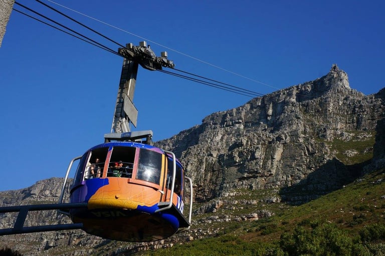
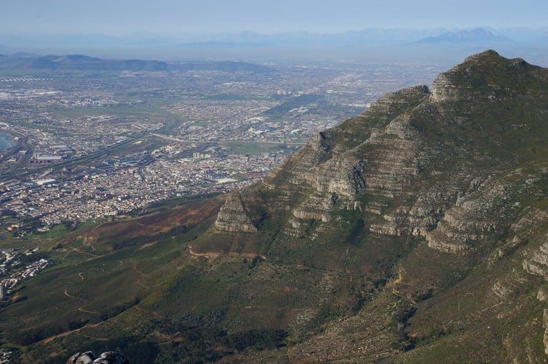
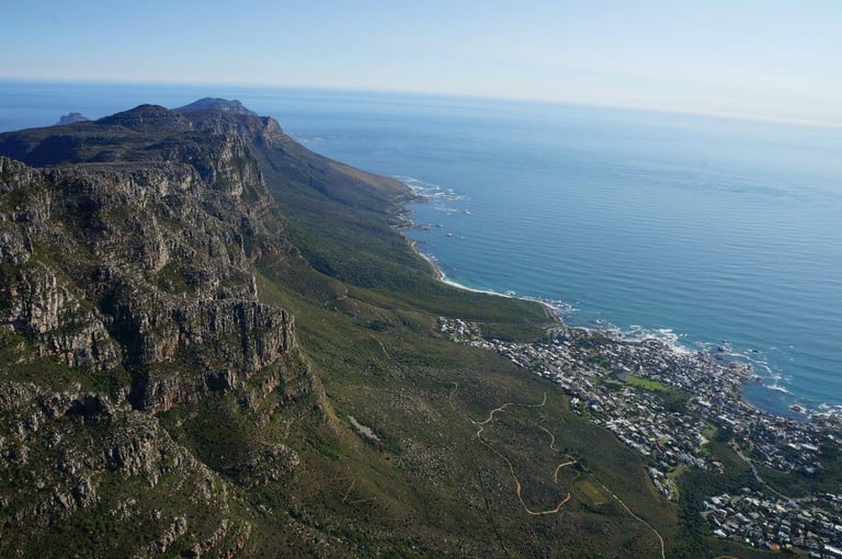
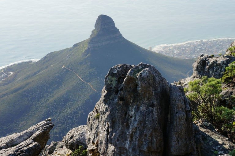
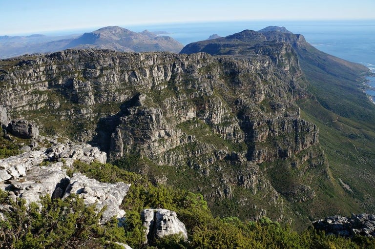
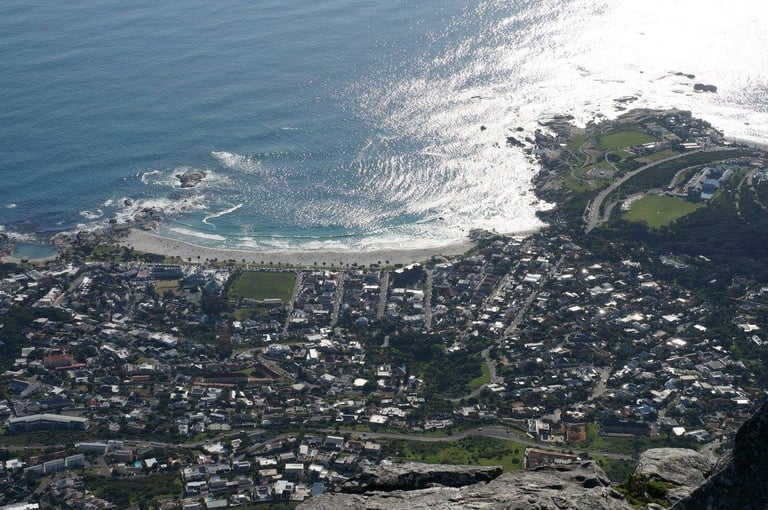
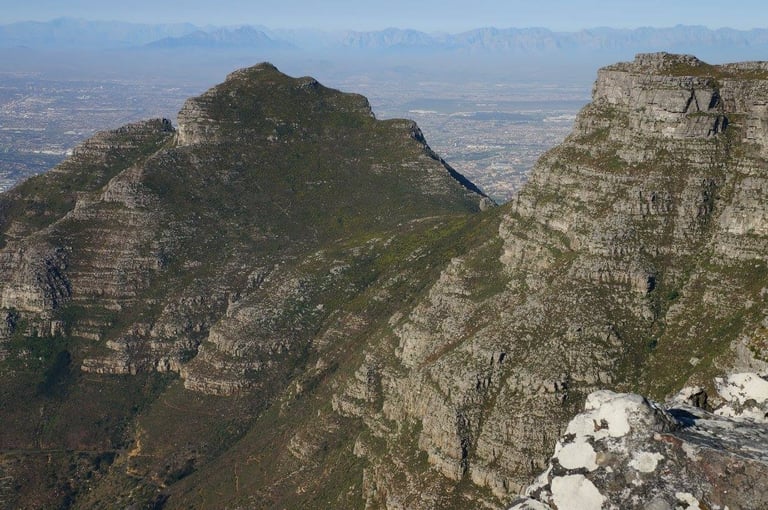
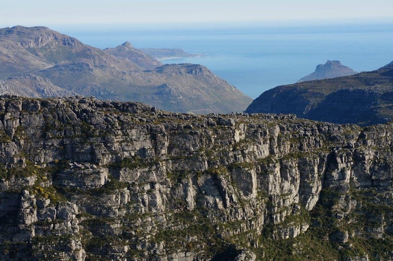
Table Mountain
I arrived on a very sunny Friday, and knowing that Table Mountain tends to be often covered in clouds, I jumped immediately at the chance of going up with the cable car when it was clear. If you go to Cape Town, do go up in the cable car, and make sure you go on a nice day, because the views really are spectacular!
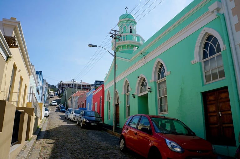
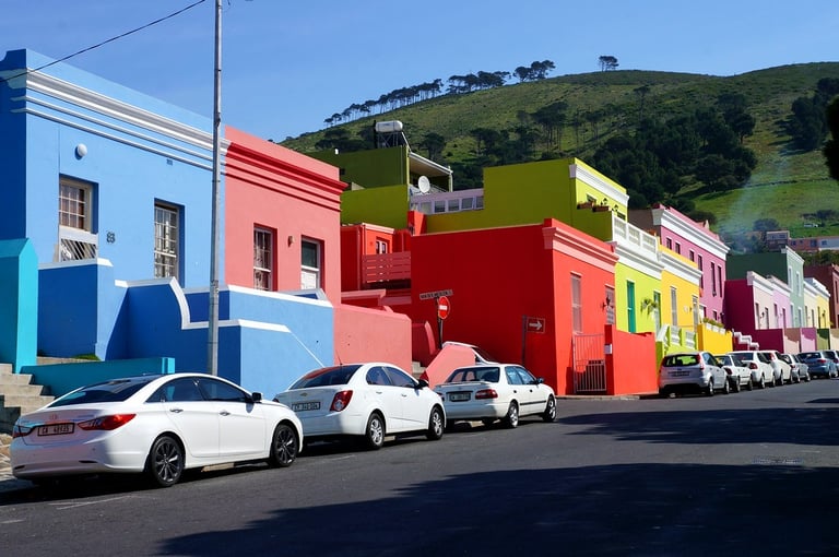
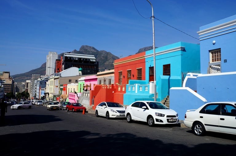
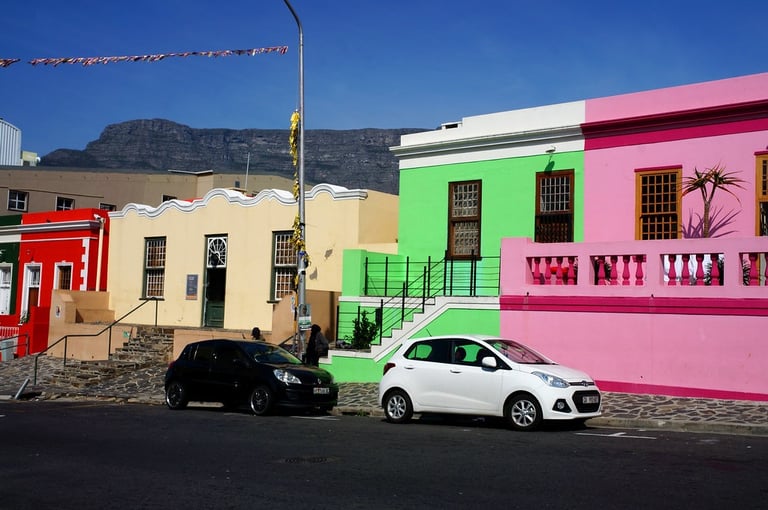
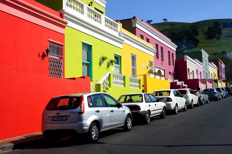
Bo Kaap - The colourful neighbourhood
This is what was formerly called the Malay quarter of Cape Town city. It is very much in the city and you don’t have to take a taxi or anything to get there as it’s absolutely in walking distance when you’re in the city centre.
Bo Kaap is popular with tourists because of its brightly colored houses. It maybe doesn’t quite live up to the hype, as when you see photos you imagine a big part of a city covered in these lovely, lively colored houses. The truth is however, that there are just a couple of streets that are like that.
It still makes for a nice photo shoot:
Clifton Beach
I always like a nice beach, and Clifton Beach was meant to be a nice beach to visit in Cape Town. And it is indeed a very pretty beach with powdery sand but I didn't have much time there, as I had just gone there after a day of touring Table Mountain and Bo Kaap.
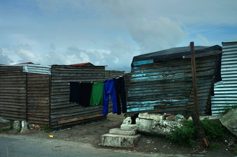
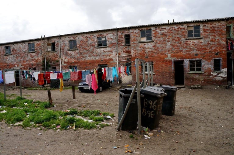
Langa Township tour
I booked through my hostel (Sunflower Stop) but was very disappointed in the guide we got. A visit to a township, that should be very educational and an eye opener, wasn’t. You could have literally asked any person from the street to take you to Langa and they’d probably do a better job than the guide we got.
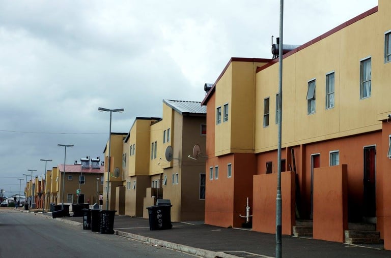
On our “tour” we were taken in a car that was in a pretty poor shape by our guide and stopped at several stalls with souvenirs, visited someone’s home and a kindergarten. We also drove for a bit around the township to see the different developments in the area.
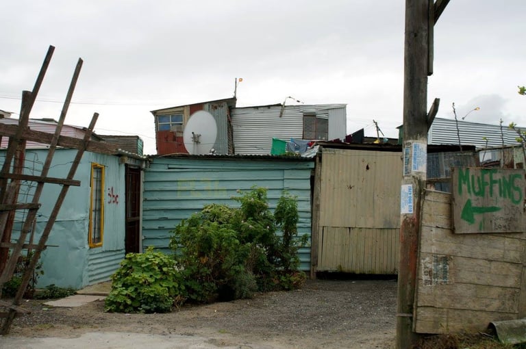
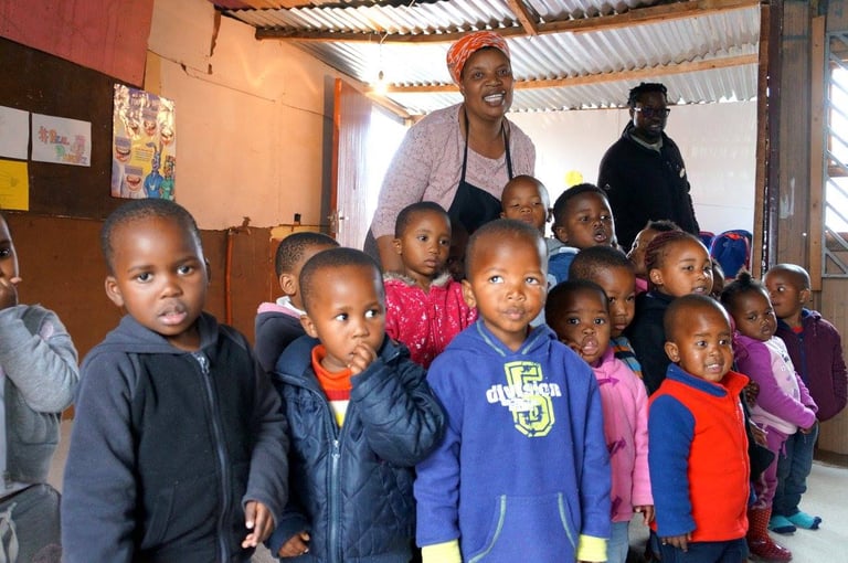
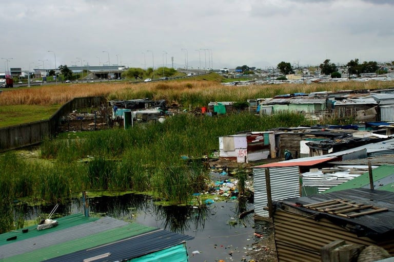
Make sure you take some cash with you. You will be expected to give little donations when visiting people’s homes, there will be lots of local souvenir sellers you may want to support and if a visit to a kindergarten is included in your visit, you might want to bring along a little gift for them – toys, books or something similar as their resources are pretty scarce.
Muizenberg
The first part of my coastal tour was taking the train to Boulder's Beach to the south of Cape Town, with a stop in Muizenberg. I chose the train, thicking it would be the nicer way of taking public transport along the Cape Peninsula, but I must say I was wrong. The train was really uncomfortable, with the windows so manky you couldn't see a thing unless you kept them open. Had I known, I probably would have just taken a taxi.
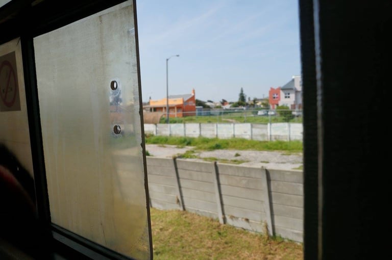
The train along the Cape Peninsula from Cape Town.
However, it's all worth it when you get off at your stops and enjoy the beautiful coastal landscape.
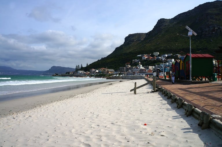
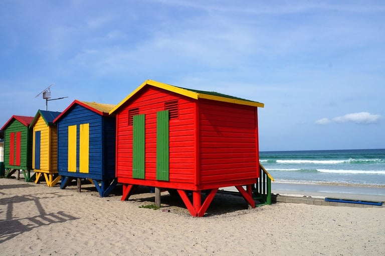
Muizenberg Beach
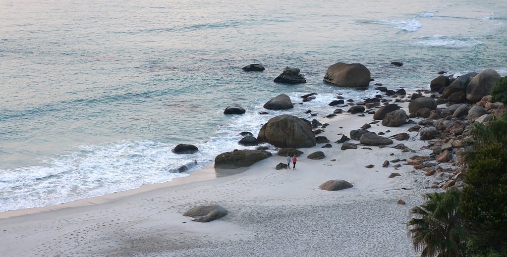
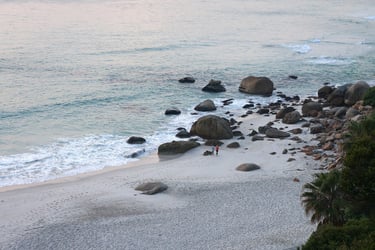
Boulders Beach
My next stop was Boulders Beach. Imagine the most picture perfect beach, then go to Boulders Beach and it will be pretty close to it! Not only is the beach utterly scenic – white sand, beach completely clean, turquoise clear water and the bay surrounded by big granite boulders, but the beach is also home to hundreds of African penguins and they are absolutely adorable!
To get there, you can get a hop on, hop off daypass for the train leaving from Cape Town station which costs something like 35 Rand (one way ticket to Simon’s Town is 20 Rand). The train is very run down to say the least, but it is definitely by far the cheapest way to go. Hiring a taxi or Uber for the day would cost you around R800, whereas the train is just R35 return.
When I visited, the trains weren’t operating all the way to Simon’s Town but you go to Fish Hoek, where you board a tourist bus that drives you to Simon’s Town train station, and then there’s a 40 minute walk southward to the penguin colony at Boulders Beach. The beach forms part of Table Mountain National Park and the entry fee is R65 per adult and R35 per child. Opening hours (in 2016) were 8am-6:30pm in summer and 8am-5pm in winter.
The protected colony African penguins (Spheniscus demersus) found on Boulders Beach are also known as black-footed or jackass penguins. This endangered species is the only penguin found on the African continent. They are famous for nesting on the sandy beaches between granite boulders and are known for their donkey-like braying call and distinctive black-and-white markings.
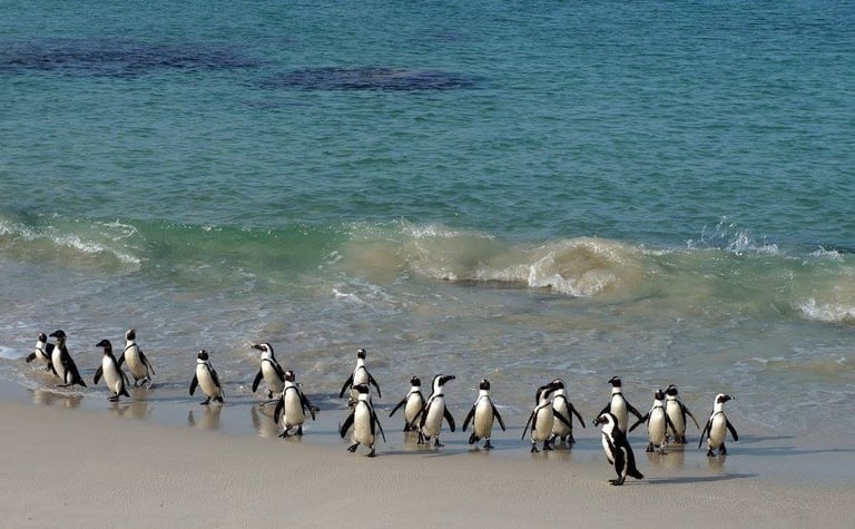
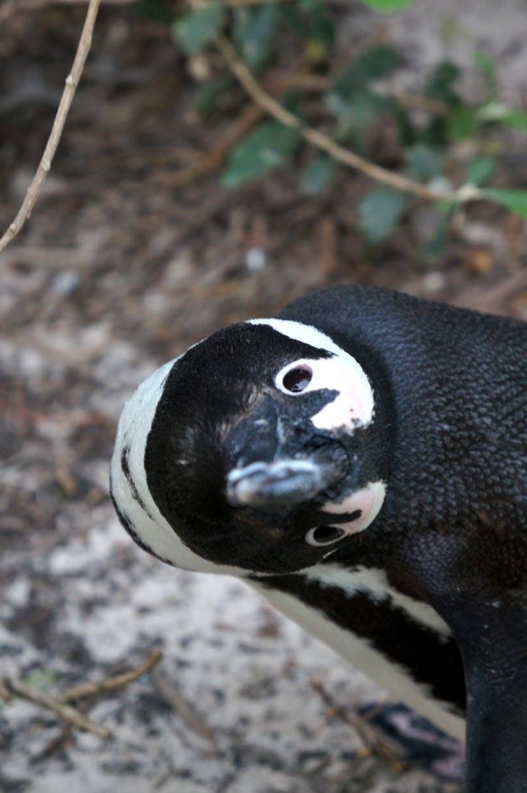
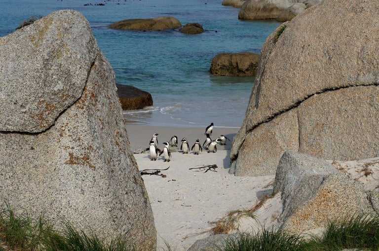
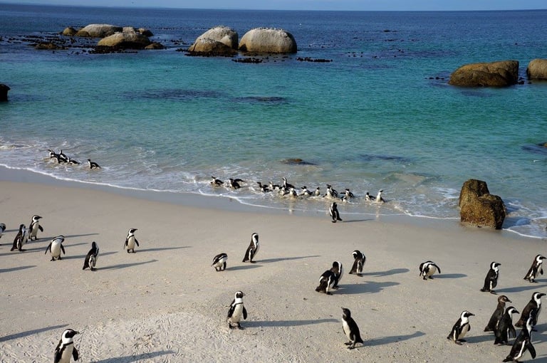
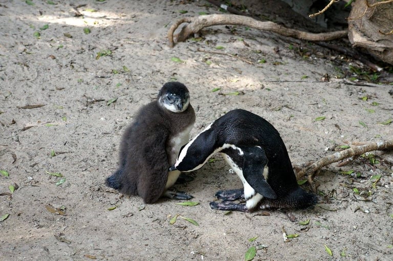
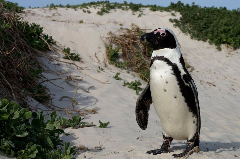
Penguins on Boulders Beach on the Cape Peninsula
I shot a few videoclips as well when I was at Boulders Beach, which are uploaded on YouTube:

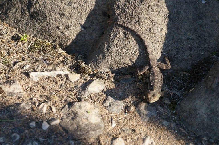
And there are not only penguins at Boulders Beach, there are also lots of rock dassies:
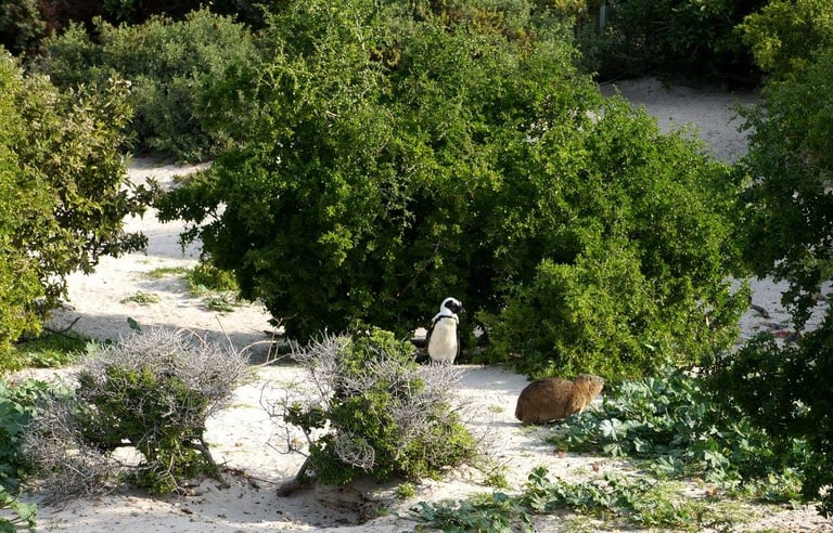
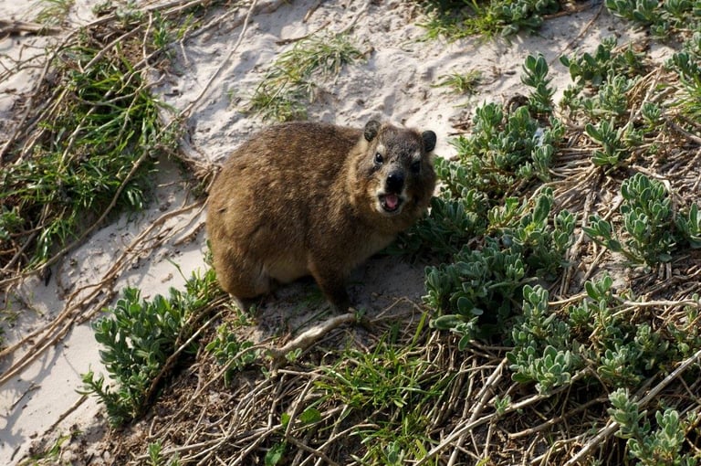
Rock dassies (or rock hyraxes) are small, herbivorous mammals native to Africa and the Middle East, closely related to elephants despite resembling large guinea pigs! (Google if you don't believe me).
They live in social colonies (10–80 individuals) in rocky outcrops and crevices. They have specialised, rubbery, moist footpads for climbing steep rocks and are known for sun-basking to regulate their temperature.
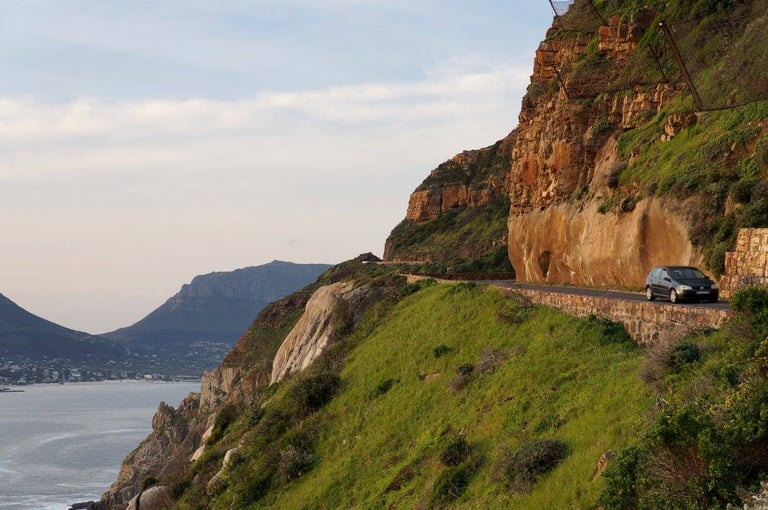
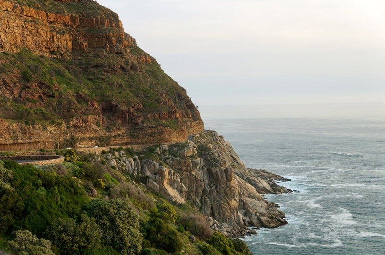
Chapman’s Peak
This is one of the most popular things to do when in Cape Town and is very easy to combine with a visit to Boulders Beach when driving back to Cape Town. It’s a scenic route and isn’t really as scary as it sounds. When I heard I was going to Chapman’s Peak, without having investigated the area properly, I thought we were going to drive up a mountain road to a mountain’s peak. However, it’s just a coastal road, cut into the side of the mountain slope and the views are amazing!
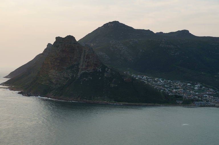
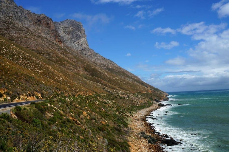
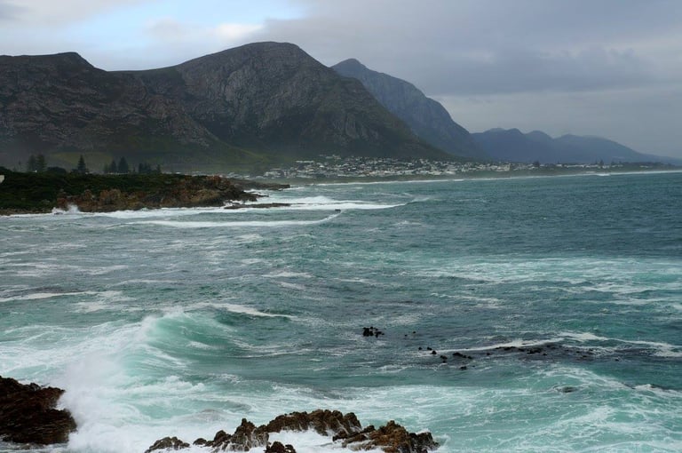
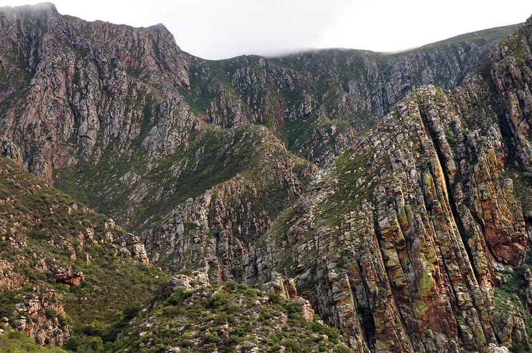
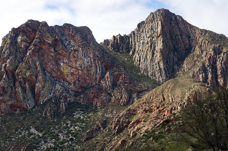
Kogelberg Nature Reserve
You drive through this reserve if you take the coastal route from Cape Town to Hermanus. I didn't really stop much to look around, aside from a couple of quick photostops of the stunning coastline.
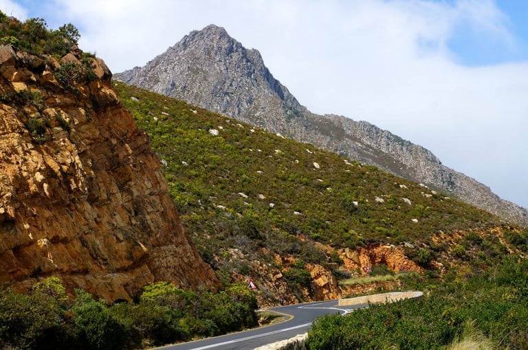
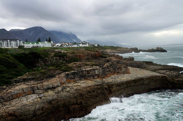
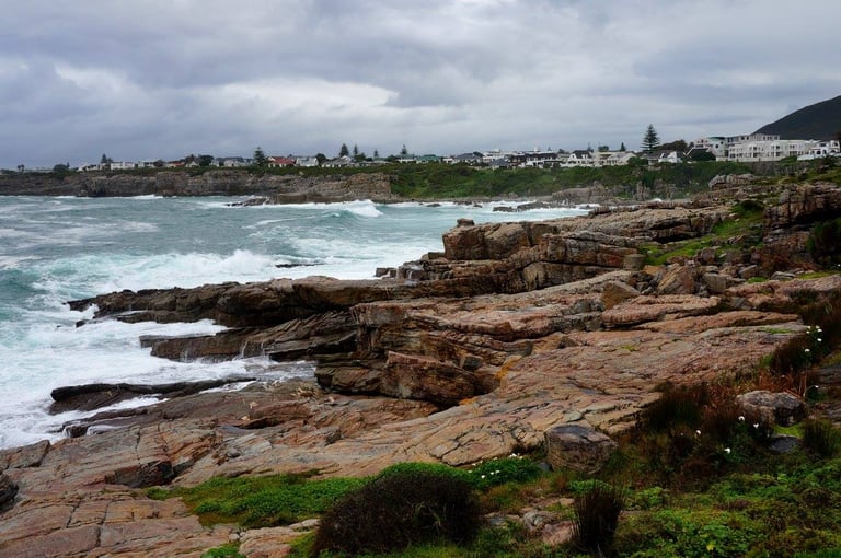
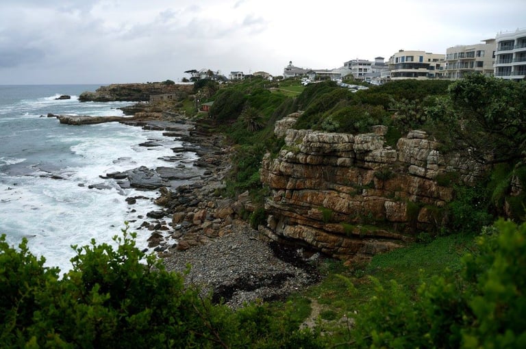
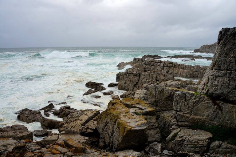
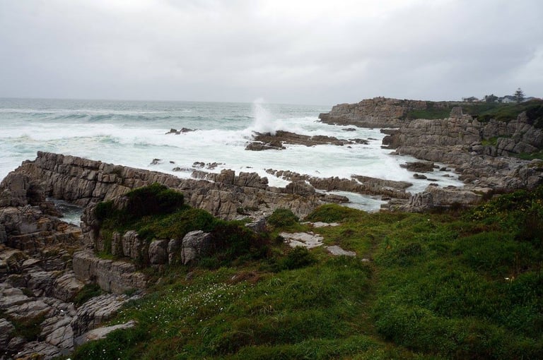
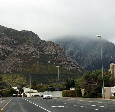
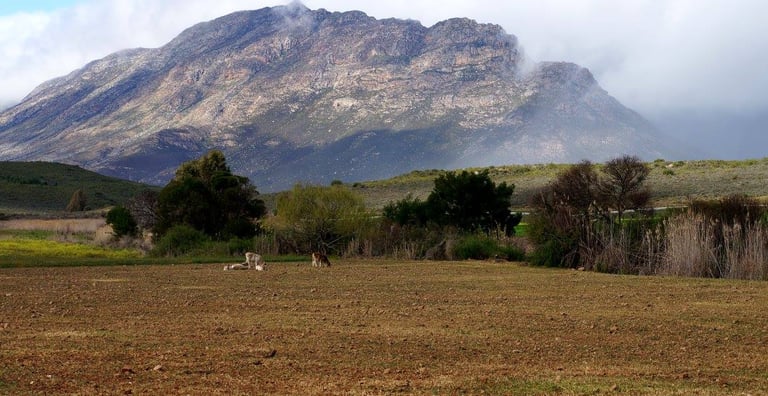
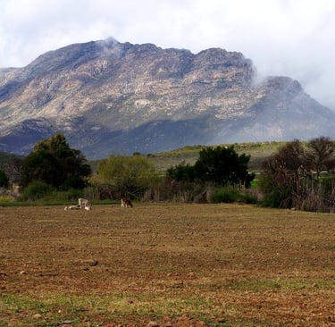
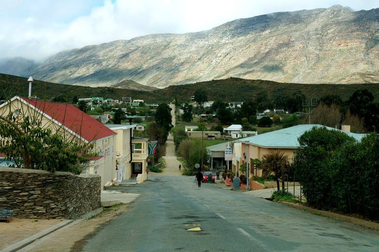
Hermanus
I only stayed one night in Hermanus, in an old fashioned hotel called Pelagus House. The aim was to walk around the town's coast and try to spot some whales, which the town is renowned from. However, the weather wasn't great, nor was the visibility so I didn't get to see any whales. But the rocks along the coast were very nice!
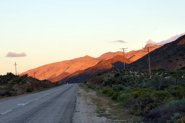
The next day I was up early, had my breakfast and headed out of Hermanus and towards Route 62.
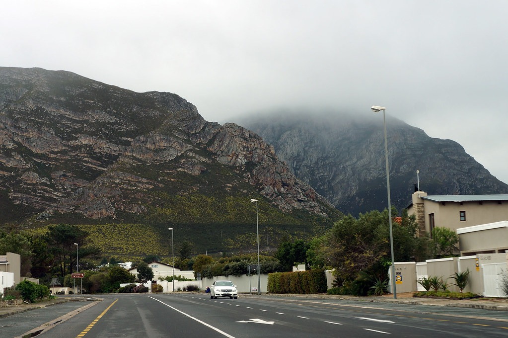
Leaving Hermanus
South Africa Road Trip - Part 2:
From Hermanus to Knysna via Route 62
Daytour from Knysna

Accommodation along Part 2 of the South Africa Road Trip
52 on Main in Knysna - not a nice place to stay and fortunately this place has closed since I was there.
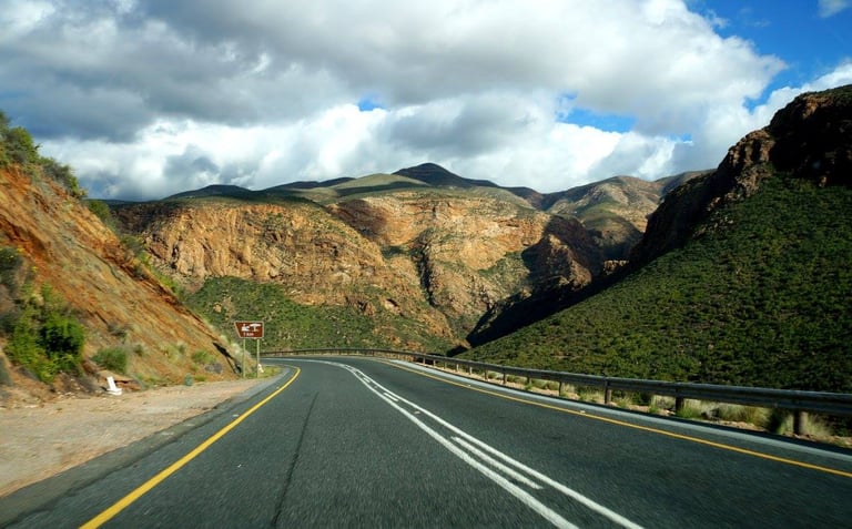
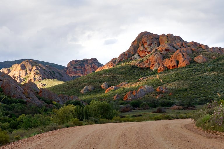
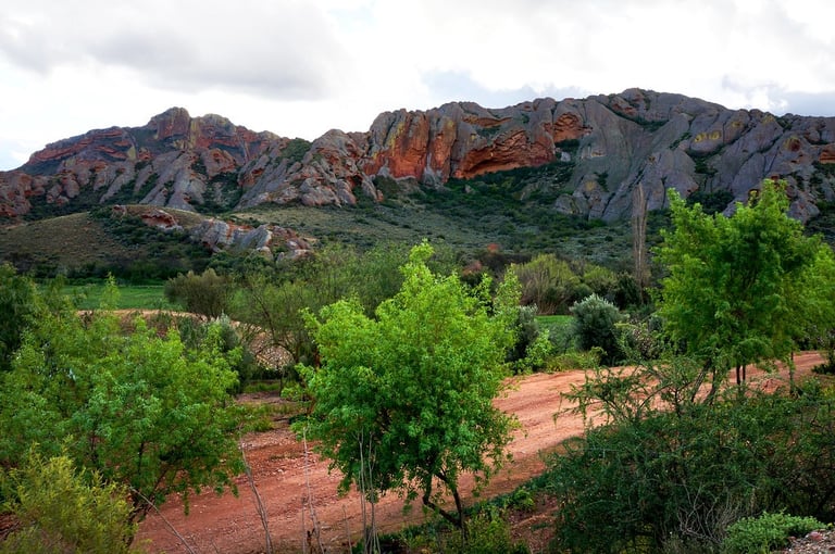
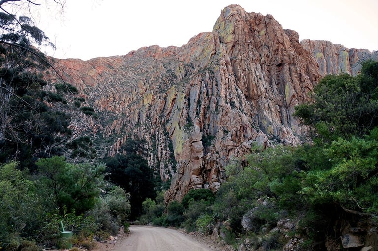
Cogmans Kloof
The second day of self-drive roadtrip across South Africa ended up being from Hermanus to Knysna via Route 62 and Swartberg Pass. What I would say is that I wouldn't necessarily recommend doing SUCH a long stint in one go. Split this route in half if you're doing it, cause there's LOADS to see!
The landscape is pretty dramatic as you leave Hermanus, but once you head inland, it’s just bunch of rolling hills but lots and lots of vineyards all around. I was very tempted to stop at one of the vineyards, but seeing at I had a long way to go and not endless hours in the day, I passed.
I didn’t really stop anywhere to be honest, until I was in the Cogmans Kloof area – an 4 km long road between the villages of Ashton and Montagu. I basically built my route around scenic drives in this part of the world according to my geological book of must-sees and I can see why the author mentioned Cogmans Kloof:


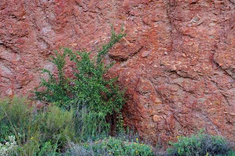
It’s hard not to be amazed when standing in front of those vertically tilted sandstone cliffs, trying to picture the immense forces required to bend entire packages of rock like that. After all, the sediments that eventually became sandstone were originally laid down in flat, horizontal layers. That’s how sedimentary rocks form, grain by grain, settling under gravity in relatively calm conditions.
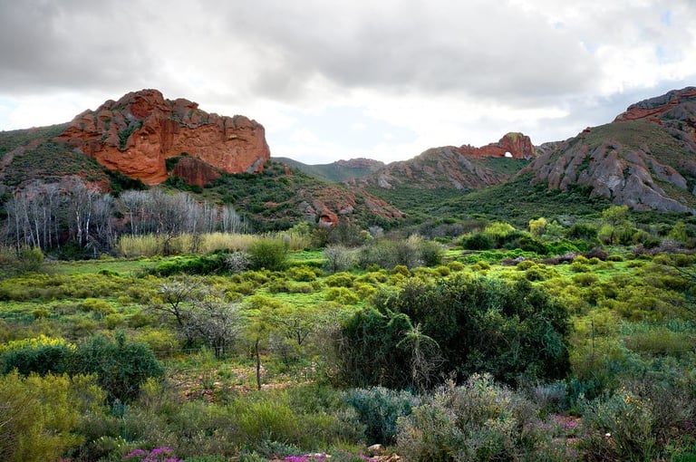
Everything changed during the Cape Orogeny, a mountain-building episode that took place roughly 280–230 million years ago. Powerful compressional forces within the Earth’s crust deformed those once-horizontal layers, folding and tilting them into the dramatic shapes we see today. The result was the Cape Fold Belt, which stretches across much of southwestern South Africa.
This mountain belt was not always confined to Africa. Before the breakup of Gondwana, it formed part of a much larger connected system. The rocks of the Cape Fold Belt were once continuous with ranges such as the Sierra de la Ventana in Argentina, as well as fold-and-thrust belts in Antarctica and eastern Australia. When Gondwana began to fragment in the Jurassic period, around 180 million years ago, South America and Africa drifted apart as the South Atlantic Ocean opened, splitting this once-unified mountain chain and carrying its pieces to different continents.
Much later, erosion took over as the dominant force shaping the landscape. Rivers gradually carved passages through the folded mountains, including the route that would become Cogmans Kloof. A road was eventually constructed through the pass in 1875, turning a natural river-cut gorge into a dramatic gateway between towns.
Today, the Cogmanskloof Pass, running from Ashton to Montagu through the Langeberg Range, offers one of the most striking and compact displays of folding in the Cape Fold Mountains. Within a relatively small area, you can see the results of intense crustal compression at their finest, a vivid reminder that even the most solid rock can be reshaped by the slow but relentless forces of plate tectonics.
As the pass is very short, aside from the main photostop, there was only oneso it for me it meant just one quick extra stop for this photo:
The name "Cogmans" can be traced back to a local Khoikhoi clan called the Kockemans or Kogmans that lived in the area in the 18th century.
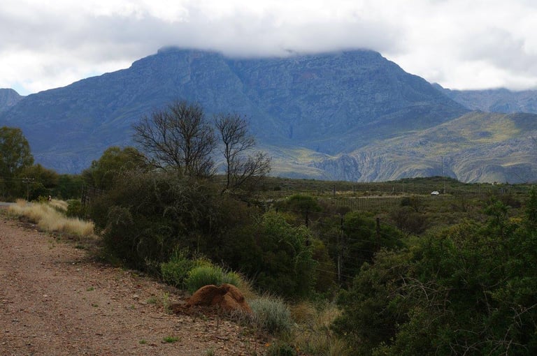
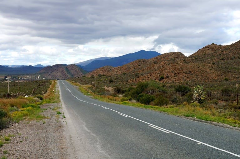
Once you’ve passed Cogmans Kloof and the village of Montagu, you’re in what is called the Little Karoo – dry mountainous area with scattered villages and vineyards.
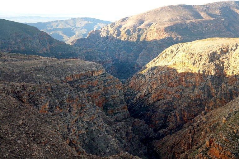
I was headed to Oudtshoorn and wanted to stop at Cango Caves, which was only a slight 30 km detour away from there. I had checked the caves’ website at one point during one of the photostops along the way and found out they required prior booking before going on the tour of the cave AND that they close at 4pm. However, once I was in Barrydale, 210 km in, I realized I was not going to make it to Cango Caves in time. It was well past lunch time, I was still to find a place to eat and then had some 2 hours 30 minutes left to drive if I was to drive non-stop. So I made a sudden change of plans – instead of going to Cango Caves, I was going to cross Swartberg Pass, if the weather was good enough.
Barrydale
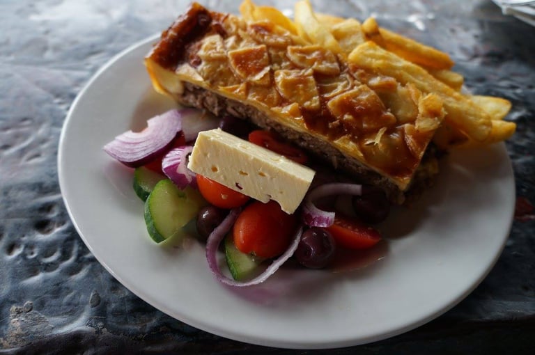
Barrydale is a village that is in such an utterly picturesque location, surrounded by mountains. Oh so pretty! They also have lots of restaurants for the travel-weary but a relatively new restaurant (est. 2013) called Diesel & Creme shot straight to the top of the charts for its tasty food, milk shakes and very fun and unusual diner decor. They’re #1 on TripAdvisor so when it came to deciding where to eat, it was an easy choice, thanks to the very many good reviews. I was definitely not disappointed with my choice – the staff were very friendly and attentive, the diner is really cool and quirky. It's a shame I've lost my pictures from there - aside from one picture as I entered the village, and another of my delicious, very filling pie!
Barrydale to Calitzdorp
Once lunch was over, I reset my phone GPS (I was using Google Maps GPS, which frankly worked a lot better than I had ever expected!) and headed the shortest way to Swartberg Pass.
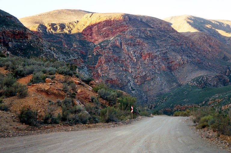
Redstone Hills to Swartberg Pass
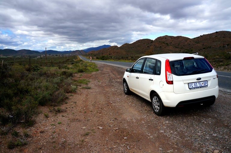
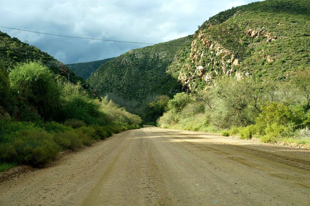
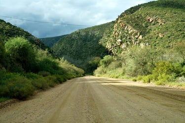
I thought Google Maps would tell me to go to Oudtshoorn and then head north. But instead it sent me a bit further along Route 62 to Calitzdorp and then turning left following a sign saying "Kruisrivier", driving northwards up a deserted dirt road with no name. I must admit, I was getting properly sceptic about Google Maps ability to navigate me through South Africa.
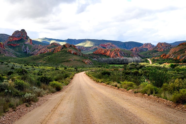
The scenery however, once I was on the dirt road, was stunning. The dirt road wasn’t bad either, so as long as I didn’t end up on someone’s private property or got into some serious trouble, I didn’t see why I shouldn’t just keep on going. Adventure time!
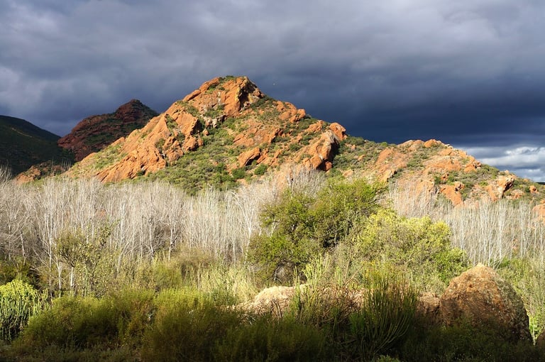
And oh boy – I wasn’t disappointed! The landscape was otherworldly, with red hills, which apparently are just simply called “Redstone Hills”, made out of ancient conglomerate which caused the landscape to look a lot different from anywhere else nearby. The hills have pretty distinct, oddly looking weathering.
I really felt like I was in a whole other world. There was nobody there – I passed a total of one car during the entire drive from the R62 junction of this nameless road to the roots of Swartberg.
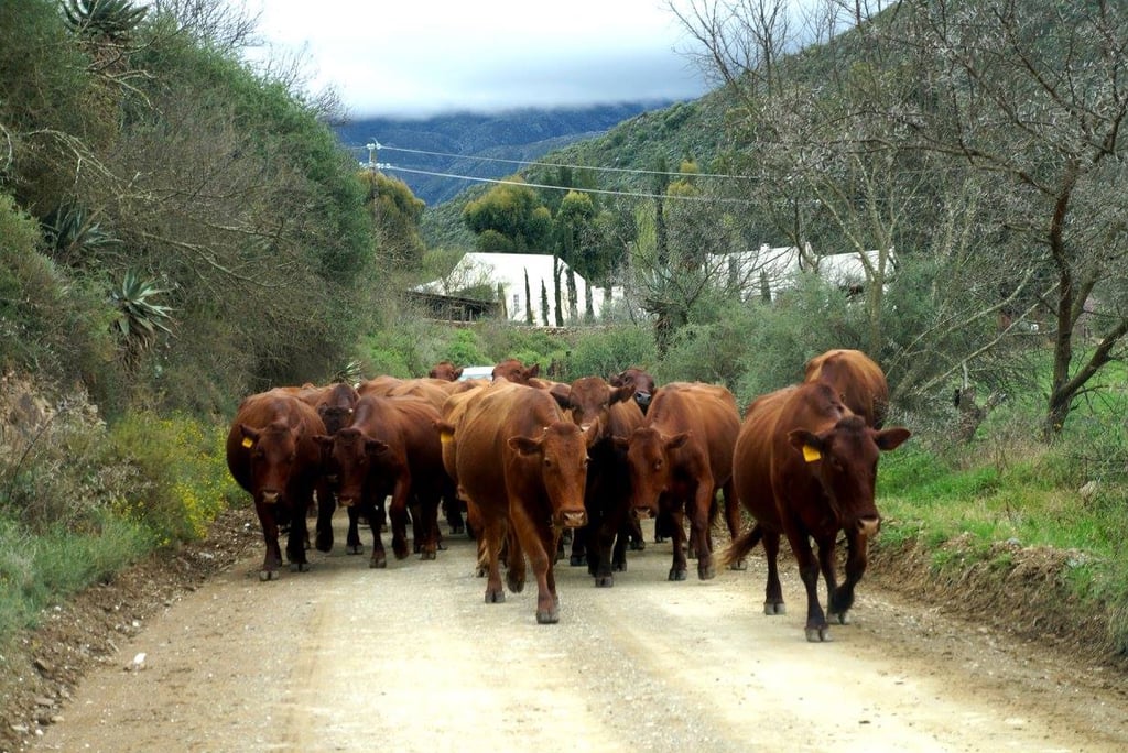
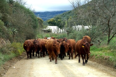
I did meet some farmers gathering their cows though!
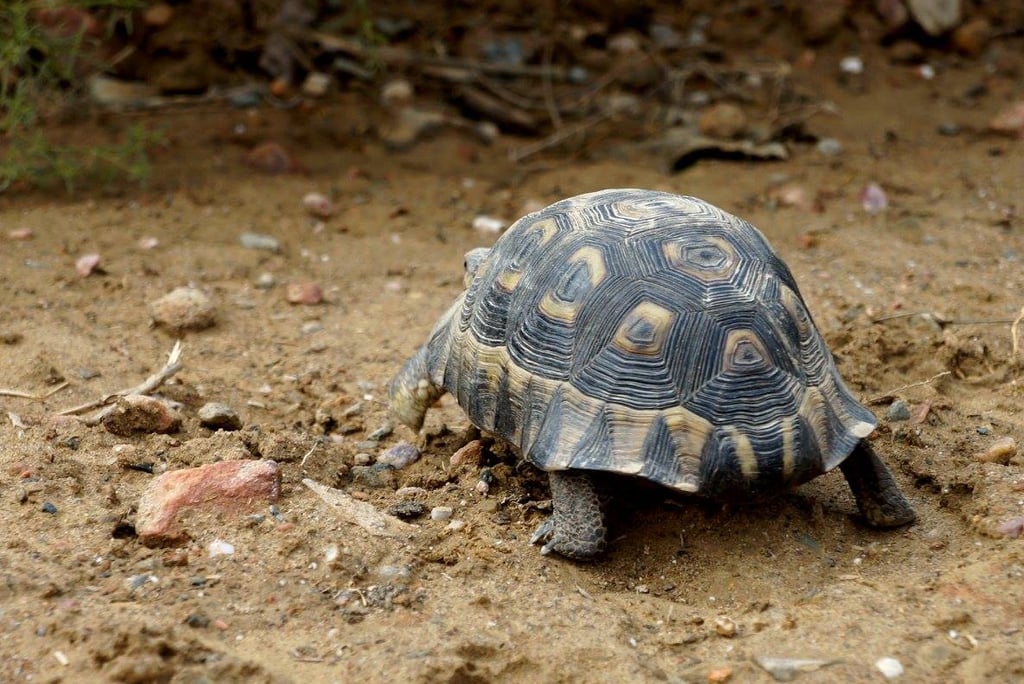
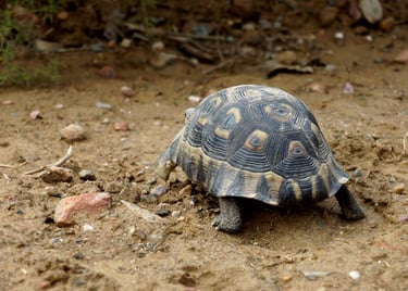
And a turtle trying to cross the road:
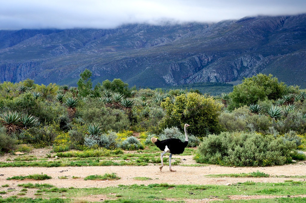
And an ostrich!

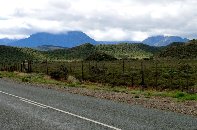
En route to Swartberg Pass, I also passed next to a fence belonging to a private game reserve called quite simply Swartberg Private Game Reserve. Basically, whenever you’re driving in South Africa and you see very high, dense fences, those fences usually belong to game reserves or national parks and are there to keep wild animals within an area and off the road. I would always keep an eye out for any animal that I might spot on the other side of the fence, and this time I got lucky and saw a herd of impalas and wildebeest:
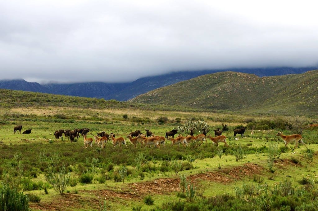
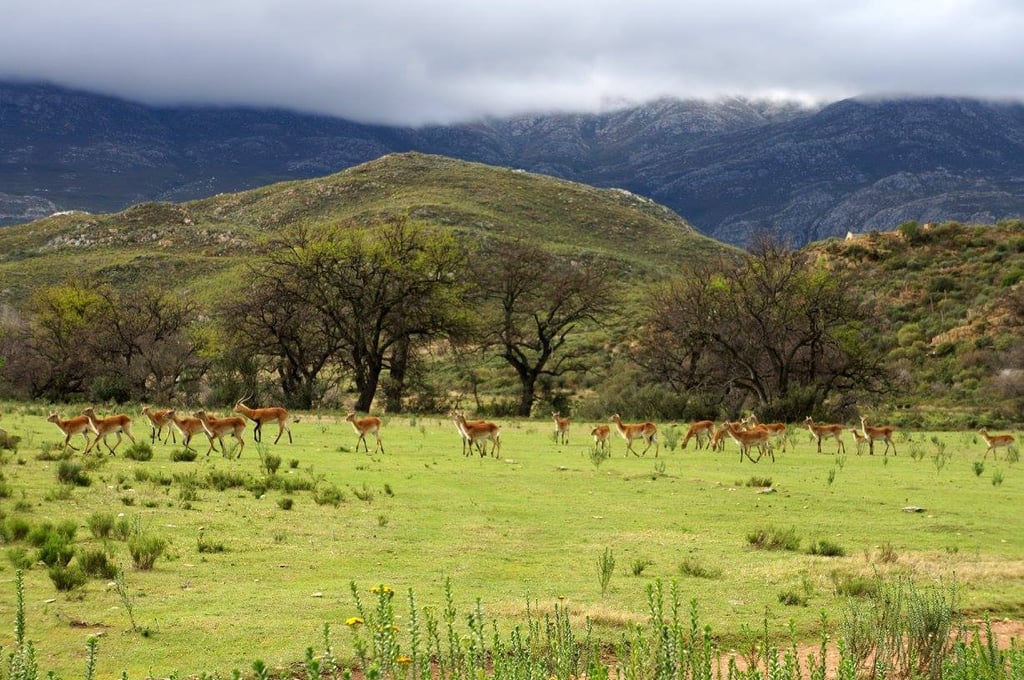
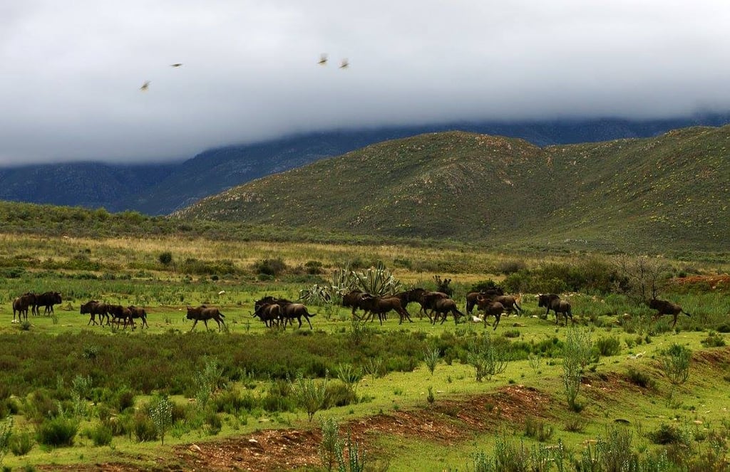
This was the first time since I had arrived in South Africa that I saw wild animals so I was pretty excited! Little did I know what was waiting for me in Kruger National Park!
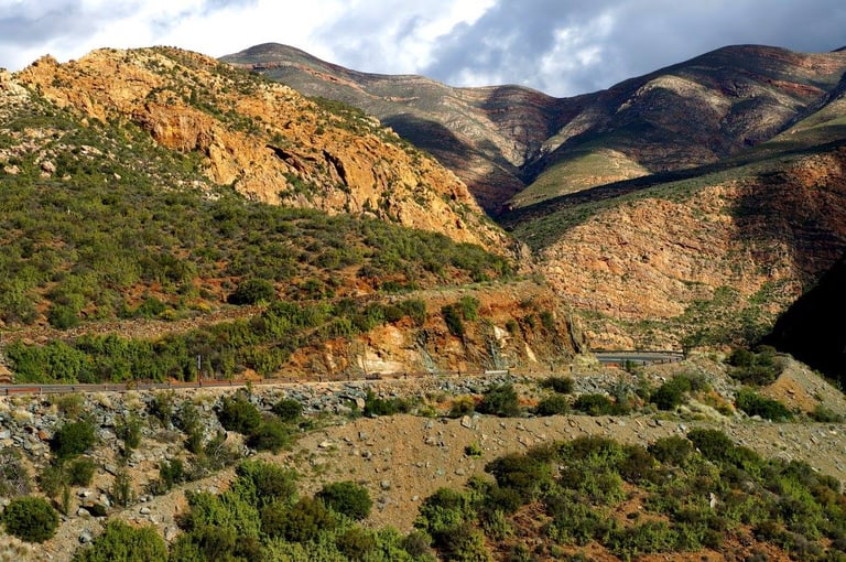
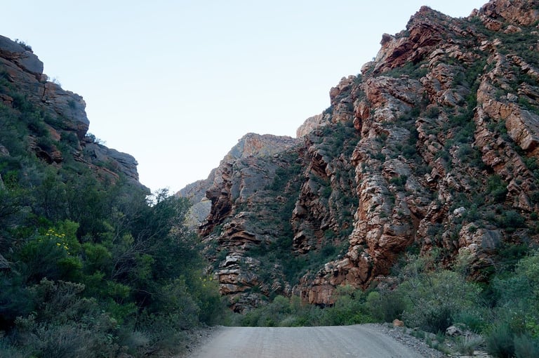
Swartberg Pass
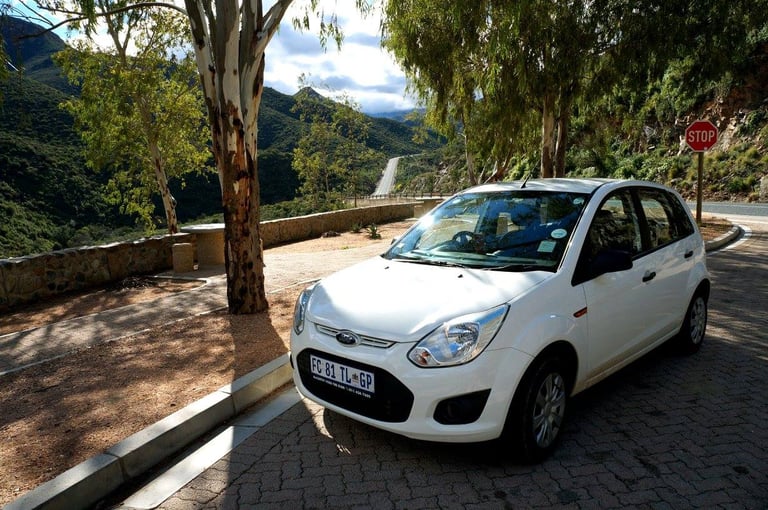
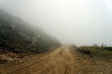
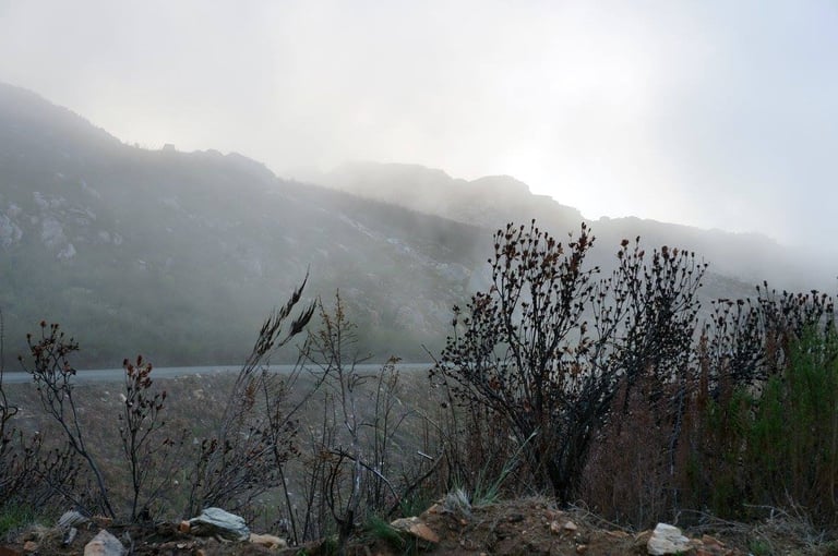
I was now pretty much at the roots of Swartberg and started climbing up the pass on my tiny Ford. You don’t need 4×4 to go over the pass, but it doesn’t hurt! But seeing I was an Icelander with plenty of offroad experience (offroad being dirt tracks), I didn’t think I’d have any issues with this pass. The weather was decent, however overcast but at least there was no torrential rain or anything that could cause flash floods or other types of difficulties. The part of the mountain that was covered in clouds however, might prove to be a bit muddy.
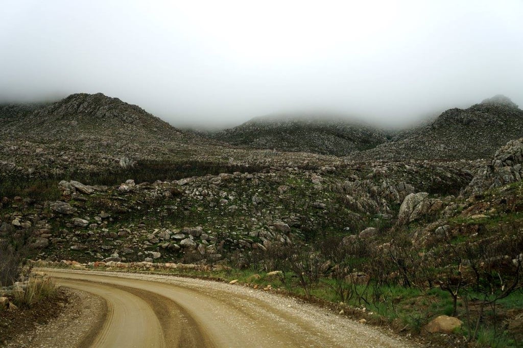

The climb up Swartberg Pass from its southern side gets quite muddy when it's rainy or foggy.
As I had gotten this far and there was nothing pointing out to me that the road might be difficult to pass, I just went along with it and decided if things started getting too scary, I could just head back.
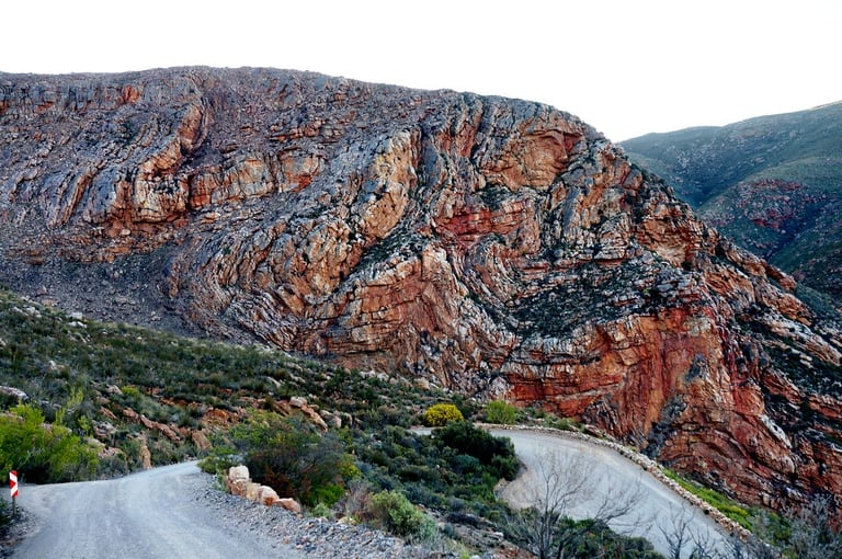
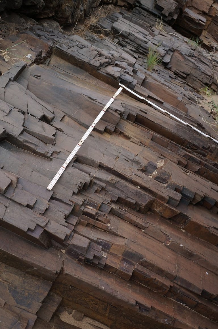
According to the book “50 Must-See Geological Sites in South Africa”, the scenery along this route was supposed to be absolutely spectacular. What makes it so geologically fascinating is that you can see the entire sedimentary sequence of the Cape Supergroup, made of the Table Mountain Group and Karoo Supergroup sandstones, shales and tillite, when travelling through the pass. So far, I wasn’t seeing very much of it though:
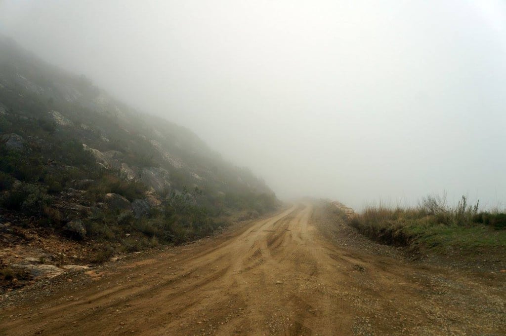
… and frankly, the road was just getting worse, with very steep climbs and muddy. My car was skidding about and I had to slow down and creep up the hill in 1st gear. But I kept on hoping that I was just about to reach the top, that soon this would get better but it just kept going on and on. There weren’t really any places to turn around either and besides, skidding downhill was something I wasn’t too keen on.
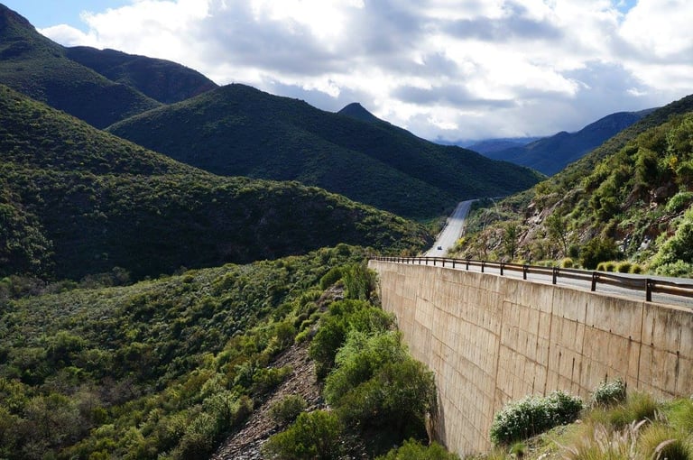
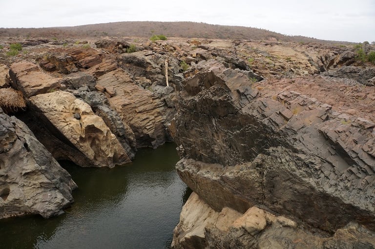
Luckily I eventually reached the top at 1568 meters above sea level and I could see it was a lot clearer on the northern side of the pass. The Swartberg Pass is 24 km long and goes through an almost impenetrable mountain barrier between the Great Karoo and the Little Karoo.
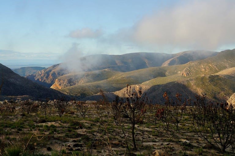
And oh, how lovely it was to slide downhill instead of climbing the steep slopes in first gear! And as I came down into the gorge between the mountain tops, I started seeing what this mountain pass was really all about. The geology here is absolutely mind-boggling, with beds of quartzite and shales squished into unimaginable shapes:
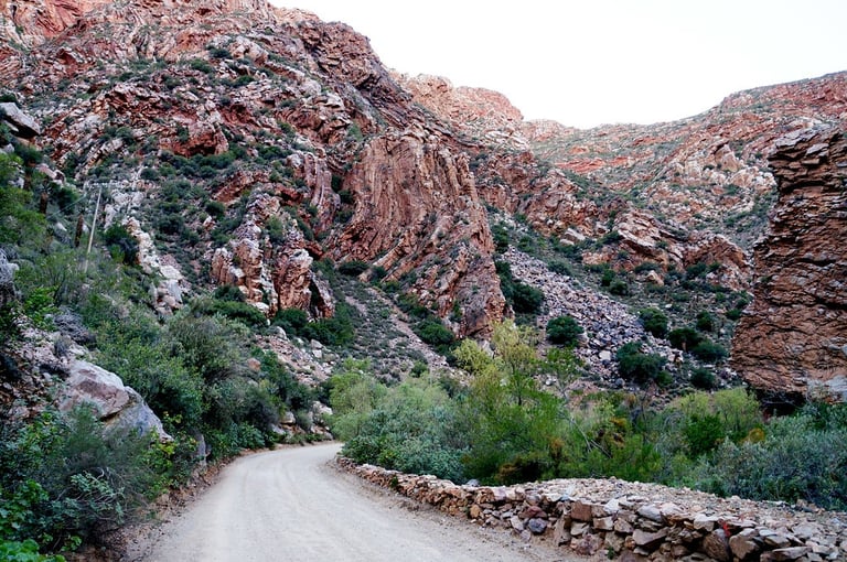
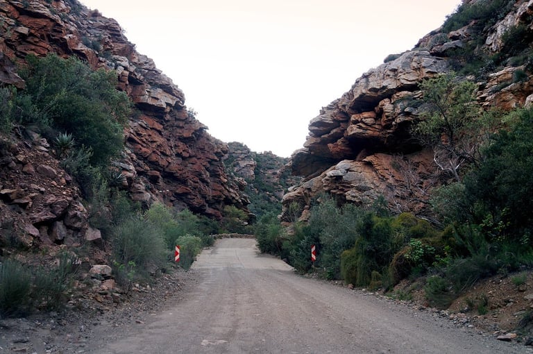
Roads tucked into tight cracks in between the mountains of Swartberg Pass… the road is definitely an engineering master piece.
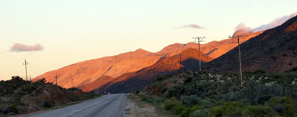
By the time I was down off the pass, the sun was setting very fast and I was still over 200 km away from Knysna, where my hotel for the night was located. I had booked and paid for the hotel months in advance, when I hadn’t really given it any thought where I was really going to go. I mean, had I gone straight from Hermanus to Knysna via N2 the whole journey would have just been 420 km on the freeway but as I decided to take R62 and then Swartberg Pass on top of that, it ended up being 644 km on all kinds of roads. I however hadn’t really expected my journey to take THIS long and so it was now certain that I would be driving in the dark for a good while.
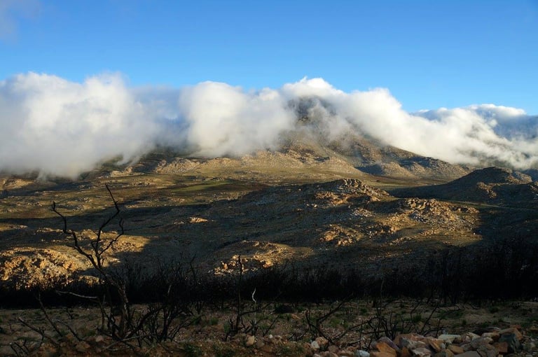
I got the last glimpse of the mountains in the sunset on the other side before it got dark:
I am not going to lie - the road over the pass can be pretty hairy at times, but it is one of the most memorable things I have evern done. The landscape is absolutely incredible, there was practically no one there, I had the place to my self. Utterly stunning. However, if you want to go but don't feel confident about driving, there are highly rated organised small group tours that take you there.
Meiringspoort Pass to Knysna
I had a choice of two routes to go to Knysna – the shorter in kilometers would be going right back over the Swartberg Pass, and there was no way in hell I was doing that. The other option was to do a bit of a loop past Meiringspoort, which by the way, is also recommended in the book of “20 Must-Sees” in the area.
The Meiringspoort pass is paved and also crosses the Swartberg mountain range, so it’s considered to be a sort of “Swartberg Pass for beginners”. It was longer in kilometers, but definitely by far the safer choice. I didn’t get to enjoy the scenery though, as it was already dark by the time I got there, but judging by the sheer vertical drops of the mountains around me as I was driving (which I could see with the help of my car’s headlights), the landscape must be pretty spectacular.
Once down off the Swartberg mountain range, I was approaching the town of Oudtshoorn. If I had planned my trip better, I totally would have stayed in Oudtshoorn, even for two nights. There are so many scenic routes all around. You can also visit the Cango Caves, the ostrich farms, see meerkats and so on, without all the rush I had to endure.
But I still don’t regret doing this route, even though my bottom was very sore at the end of it, even though I had to rush all the way to Knysna in the dark. I knew from the start that I would have limited free time in the Western Cape, and I still believe that I made the most of it and that I got to see a lot.
I eventually arrived at my accommodation "52 On Main" in Knysna at 10pm. I was taken to my room and had a chat with Joe on Facebook messenger, as I hadn’t spoken to him all day. Then when I finally went to bed, it was almost midnight. I lifted up the covers of the bed and to my utter horror, it looked as if the bed hadn’t been cleaned at all since the last person was here. There literally was a dried out puddle of dirty sweat where the person had been laying down on his / her back. EWWWWW…. !!
I went downstairs to see if the guy who took me to the room was still there, but he wasn’t. Yuck, yuck… I had to stay in that filthy bed!! But the bed was quite big, so I thought I’d check the other side of it, if maybe it was better. But on that side there were dark brown streaks of something that looked like either faeces or blood, neither of which I was willing to sleep on. I was becoming increasingly frustrated, not knowing what to do. Then I thought I would need to sleep no matter what, so I took one of the large, clean towels, laid it over the area I planned to sleep on, and the small towel over the pillow and went to bed, totally creeped out.
Needless to say, I complained to the owner when he had arrived the next morning. Luckily this place has closed down since.
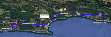
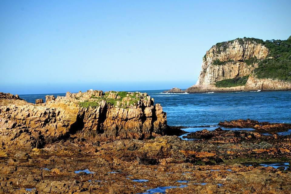
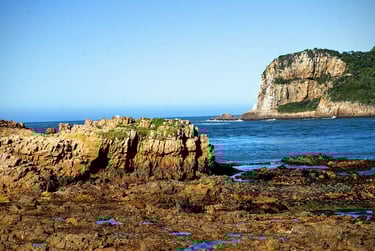
Knysna Heads
Knysna Heads is a very short drive to the coast from Knysna town and is featured in the book 50 Must-See Geological Sites in South Africa. The coastline consists of strongly jointed, south-dipping strata of hard Table Mountain Group quartzite, the same quartzites that make up the cliffs of Table Mountain in Cape Town. Knysna Heads is the remnant of the extensive coastal plain that is present throughout the southern Cape, and originally part of a wave-cut platform that was later elevated more than 200m above sea level.
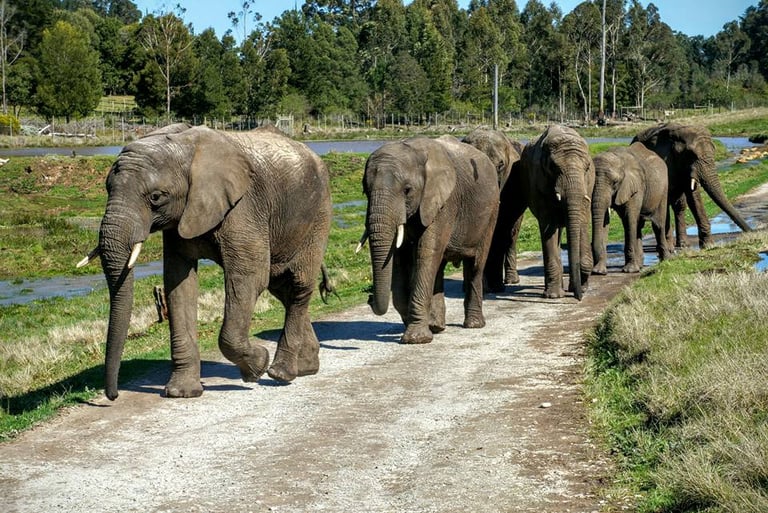
Knysna Elephant Park
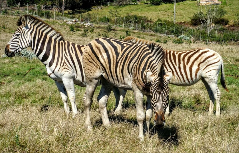
Established in 1994, the Knysna Elephant Park in South Africa is a pioneering facility dedicated to the rescue, rehabilitation and care of orphaned or displaced African elephants. Located between Knysna and Plettenberg Bay, it features the country's largest domesticated matriarchal herd and offers responsible, up-close, and educational interactions. The park has cared for over 40 elephants, including orphans, ex-circus animals and those rescued from culls. It focuses on ethical, guided, and educational encounters, such as feeding, walking, and observing the herd in a 200-hectare habitat. There are also some other animal species, or at least there were when I went, including zebras.
I always prefer to see animals in their natural habitat, though if you do like coming up close and personal with animals, you might like this place. I just wish we didn't need these places, that people would just stop mistreating animals.
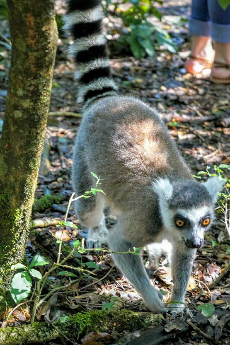
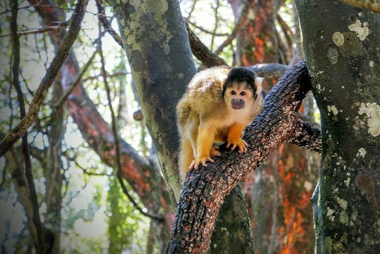
Knysna Monkeyland
When I was in Knysna I went to visit Monkeyland. It is the world’s first free-roaming, multi-species primate sanctuary, offering "monkey safaris" to see 12 species of primate and over 550 primates. The sanctuary features a 128-meter suspension bridge for unique forest views with possibilities to see the following primates:
Black and White Ruffed Lemur
Ringtail Lemur
Red-Bellied Lemurs
Brown Lemurs
Bolivian Squirrel Monkey
Brown Capuchin
Red-backed Bearded Saki
Black Howler Monkey
Vervet Monkey
Geoffroy’s Spider Monkey
Hanuman Langurs
White-Handed Gibbon
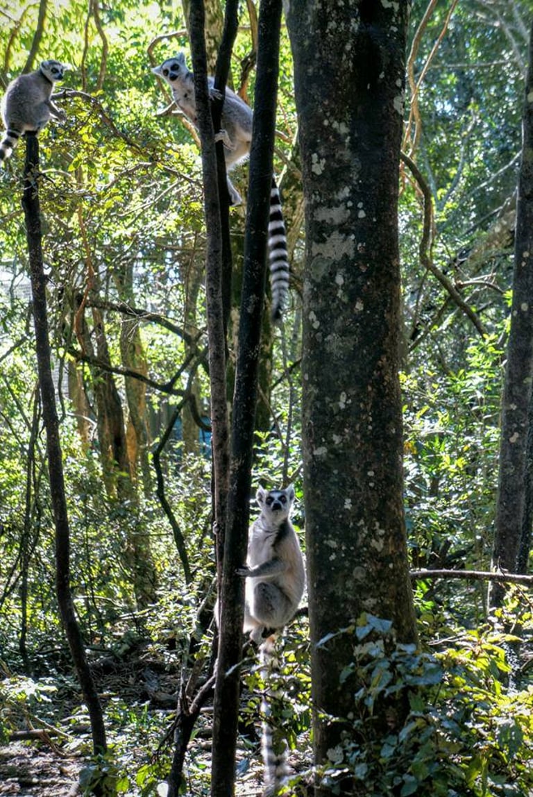
A few of the Monkeypark residents
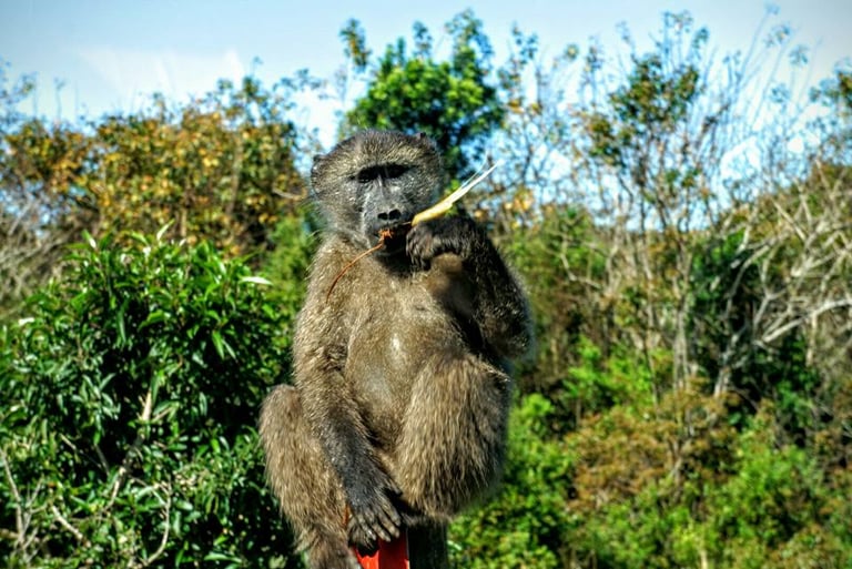
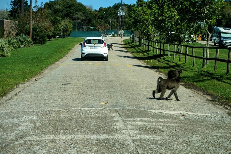
It's quite funny when I was approaching the Monkeyland sanctuary, there was a fair number of baboons hanging around. Maybe they were attracted to the sounds of the monkeys and lemurs, and felt they were missing out? Who knows! But they probably wouldn't make the most peaceful residents if they were let in.
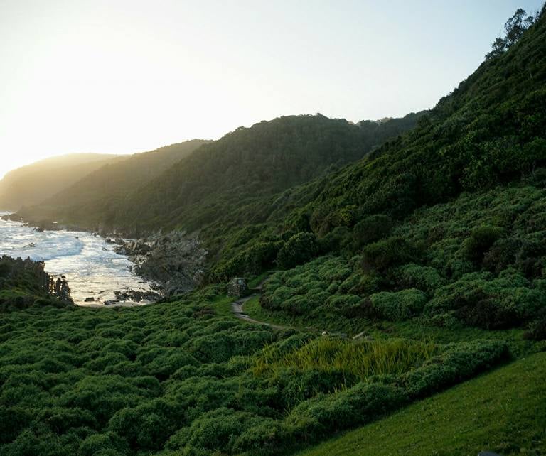
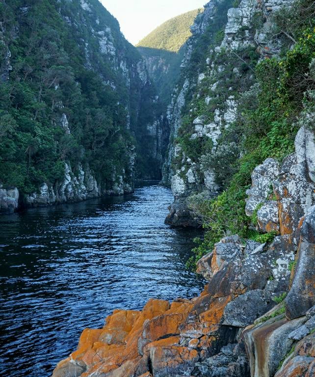
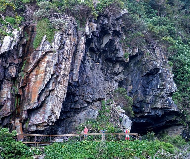
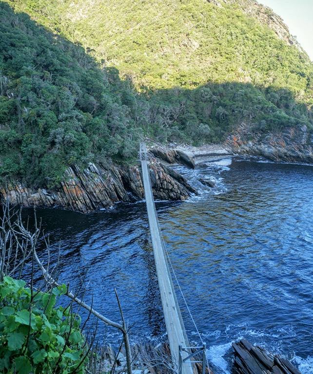
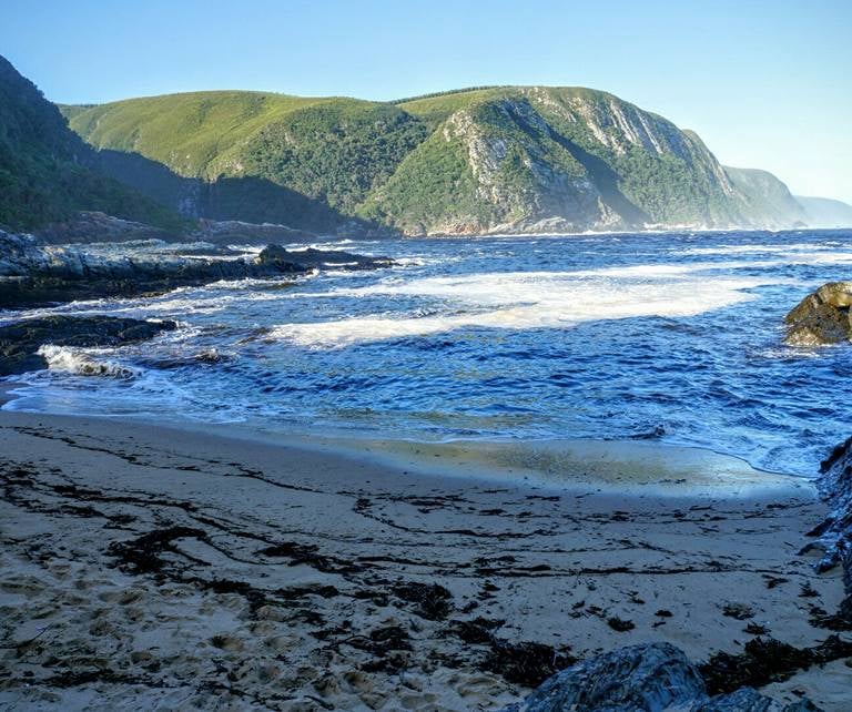
Storm River Mouth in Tsitsikamma National Park
I drove to Storm River Mouth from Knysna towards the end of the day. The coastline is very dramatic. It was also extremely green and lush, very different from the very arid interior around Route 62 beyond Montago and the Swartberg Pass.
South Africa Road Trip: Part 3
Eastern Bushveld, Mpumalanga Drakensberg Escarpment and Kruger National Park
An excursion organised through the International Geological Congress in Cape Town 2016 and led by Morris Viljoen

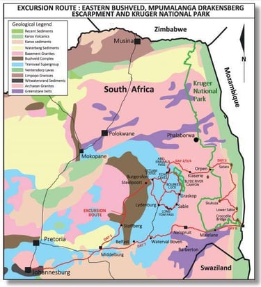
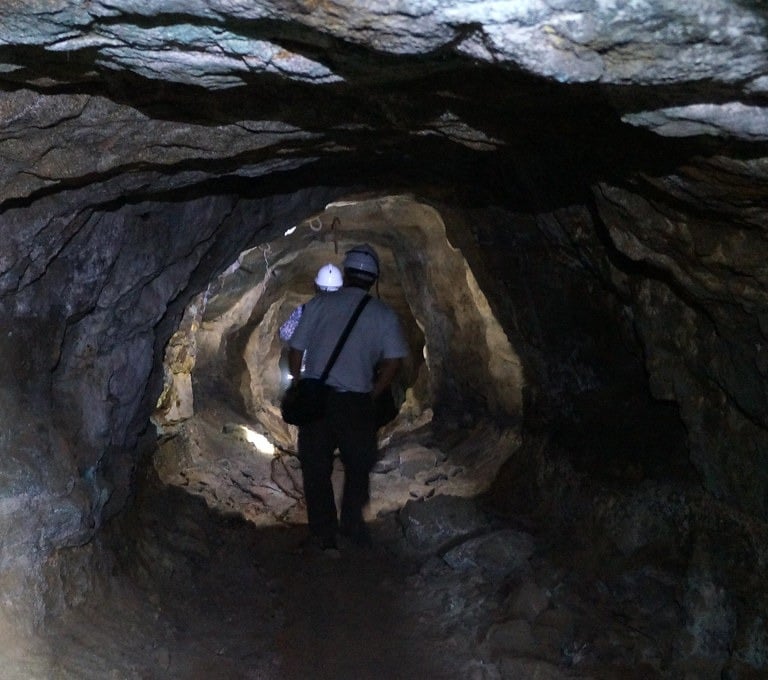
This 7 day excursion lead by Professor Morris Viljoen was designed to provide an overview of the geological and geomorphological superlatives of three world famous regions of South Africa. The first part of the excursion was focussed on the well exposed northeastern limb of the Bushveld Complex with its spectacular layered igneous rock assemblage which includes pyroxenite, norite, anorthosite and gabbro. These rocks host layers of chromitite, platiniferous pyroxenite and vanadiferous titano magnetites. The layers are traceable for hundreds of kilometres around the Bushveld Complex and contain the world’s largest reserves of chromium, platinum and vanadium. Exposures of all of the above together with an exposure of one of the famous hortonolite dunite pipes on which the first platinum mining took place in the late nineteen twenties, will be viewed.
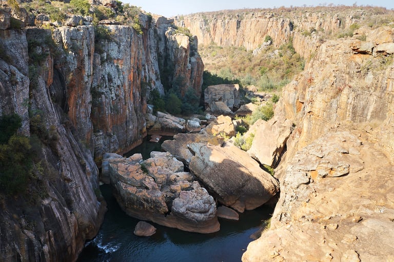
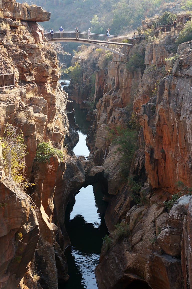
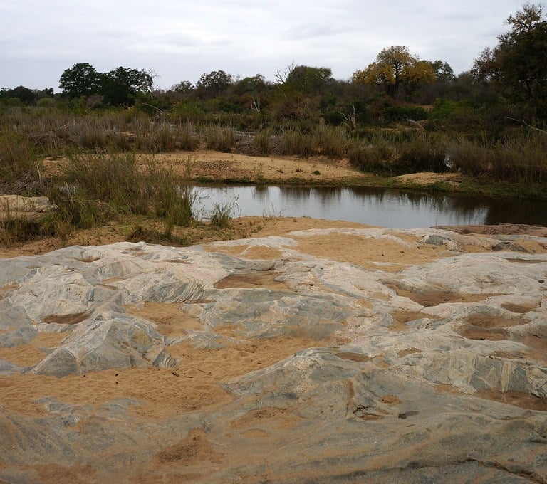
The second part of the excursion traversed the eastern highlands and eastern escarpment edge. Quartzite and shale horizons of the Pretoria group, intruded by numerous diabase sills, form the highlands, while resistant, quartzite dominated formations of the Wolkberg and Black Reef formations form the scenic escarpment edge. These formations are overlain by dolomite with well developed stromatolite structures in many places. Several tourist caves with dripstone formations, calcareous tuffa deposits, both active and extinct, are characteristic of the dolomite terrain. Headward erosion of several rivers including, from south to north the Crocodile, Sabie and Blyde rivers and their tributaries have incised the escarpment region by the process of headward erosion. This has given rise to a range of scenic waterfalls at nick points on harder rock formations. Potholes are spectacularly developed and have clearly been a major force in the incision of hard rock formations to initiate gorge formation as in the case of Bourke’s Luck potholes and the spectacular Blyde River Canyon.
The third part of this trip traversed the central and southern portions of the world famous Kruger National Park and the major rock formations and geomorphological features were examined at a number of localities. Rock types in the Archaean basement granitic terrain range from granite inselbergs in southern Kruger, granitic migmatites, diabase dykes and the Timbavati gabbro intrusion. Karoo basaltic lava plains underlie much of eastern Kruger and are overlain by rhyolite, the latter forming the Lebombo range along the Mozambique border.
As part of the drive through Kruger the distinctive soil types and ecozones developed on different rock types were highlighted. As part of the above itinarary, we also had the opportunity to see “Big Five” comprising elephant, rhino, lion, buffalo and leopard, together with a large range of other animals in this unique national park.
Accommodation along Part 3 of the South Africa Roadtrip
Gethlani Lodge near Burgersfort, situated on a game farm in bird-rich indigenous forest.
Hannah Lodge - a game lodge offering a true Bushveld experience
Forever Resort in the Blyde River Canyon, situated on the edge of the canyon overlooking the gorge
Orpen Camp - a small camp at the central entrance gate on the western border of Kruger National Park
Skukuza Camp - the largest camp in Kruger on the banks of Sabie River.
Crocodile Bridge Rest Camp next to Crocodile River near the Malelane Gate in Kruger National Park
Peermont Mondior Hotel at Emperors Palace in Johannesburg; a Las Vegas feeling at this hotel.
Magnet Heights
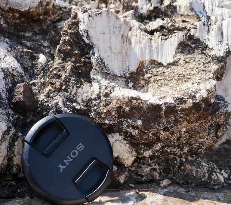
Magnet Heights (often referred to as Magneetshoogte) is a, geological site and small locality in the Limpopo province of South Africa, specifically within the Sekhukhune District. It is renowned for exposing the Upper Zone of the Bushveld Complex, featuring significant, 2m thick layers of magnetitite. It also contains carbonatite dykes, often linked to the nearby Spitskop alkaline complex. It is situated approximately 10 miles west of Steelpoort town in the Limpopo Province.
Located in the Eastern Bushveld Complex, the area is a key site for studying layered mafic rocks, including magnetitite, anorthosite and pyroxenite, which represent some of the uppermost 6,000 feet of the intrusion. The site is famously used as a laboratory to study the formation of magnetite layers within the Bushveld complex.

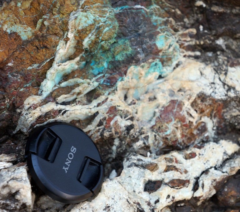
Upper Zone of the Bushveld Complex at Magnet Heights (Magneetshoogte) featuring thick layers of magnetite and carbonatite dykes
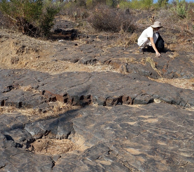
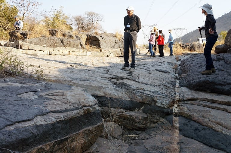
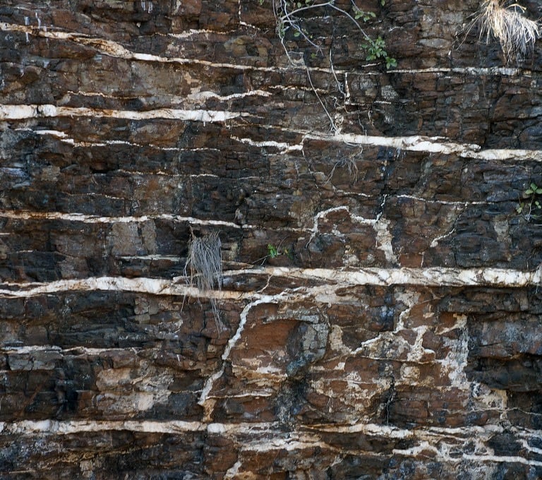
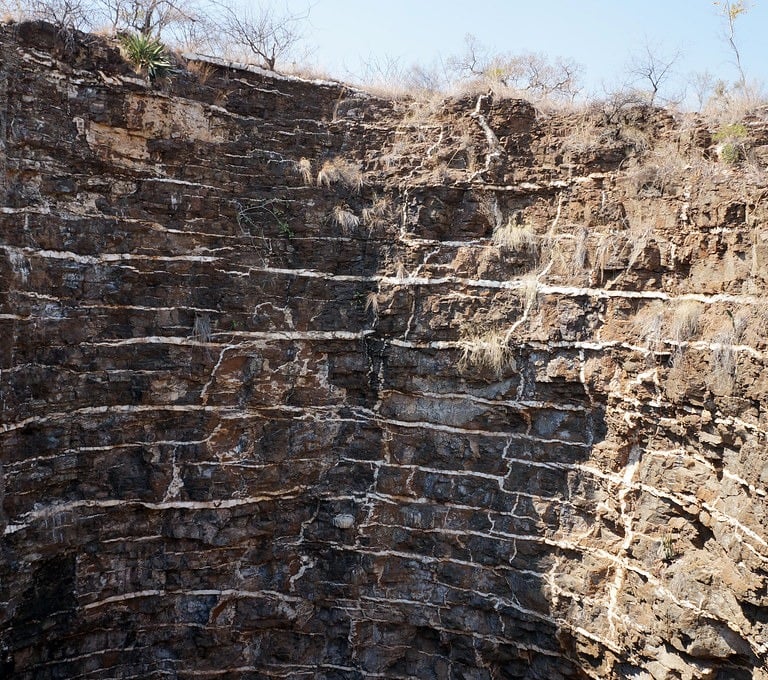
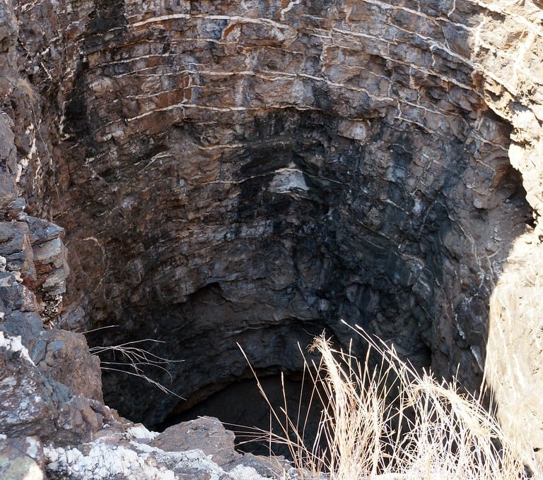
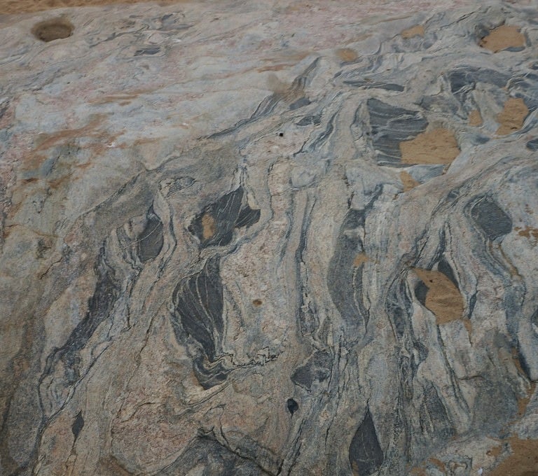
Dwars River National Monument in the Bushveld Complex
Dwars River National Monument preserves one of the most impressive natural displays of layered igneous rocks in the region. It lies within the Bushveld Complex, one of the largest and best-exposed layered mafic–ultramafic intrusions on Earth. This enormous body of rock formed about 2 billion years ago, when magma rising from deep in the mantle was injected into the crust and cooled slowly, allowing minerals to crystallise and settle into distinct layers.
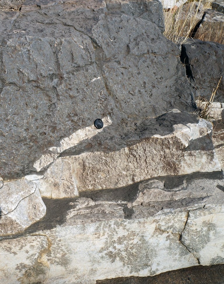
The monument is especially well known for exposing the Upper Group 1 (UG1) chromitite layers. These are relatively thin but laterally extensive bands of chromium-rich rock, interlayered with lighter-coloured anorthosite, which is dominated by the mineral plagioclase. Together, these alternating layers record repeated pulses of crystallisation in a large magma chamber. As the molten rock cooled, dense chromite crystals formed and sank, sometimes being reworked by currents within the chamber. This produced striking, repeated banding patterns that are both visually dramatic and scientifically important.
Geologically, the site forms part of the Rustenburg Layered Suite within the Bushveld Complex. This suite is divided into several zones—lower, critical, main, and upper—based on changes in mineral composition and layering. The critical zone, which includes the UG1 layer, is particularly significant because it hosts major seams of chromite and platinum-group elements. These mineral-rich layers are a key reason why the Bushveld Complex is such an important global source of chromium, platinum, and palladium.
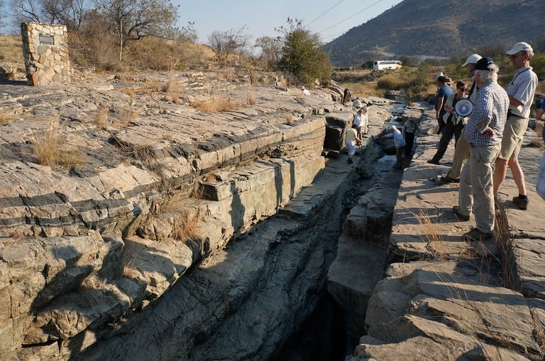
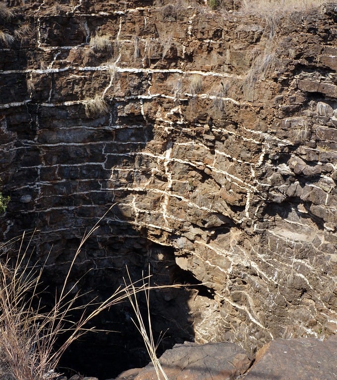
At Dwars River, the river has carved a narrow canyon through these layered rocks, neatly slicing through the sequence and revealing the alternating chromitite and anorthosite bands. The result is a remarkable natural cross-section of a long-solidified magma chamber, offering geologists a clear window into how large layered igneous bodies form and evolve.
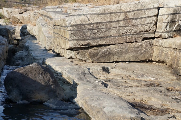
Dwars River Bushveld Complex Upper Group 1 (UG1) chromitite layers and anorthosite
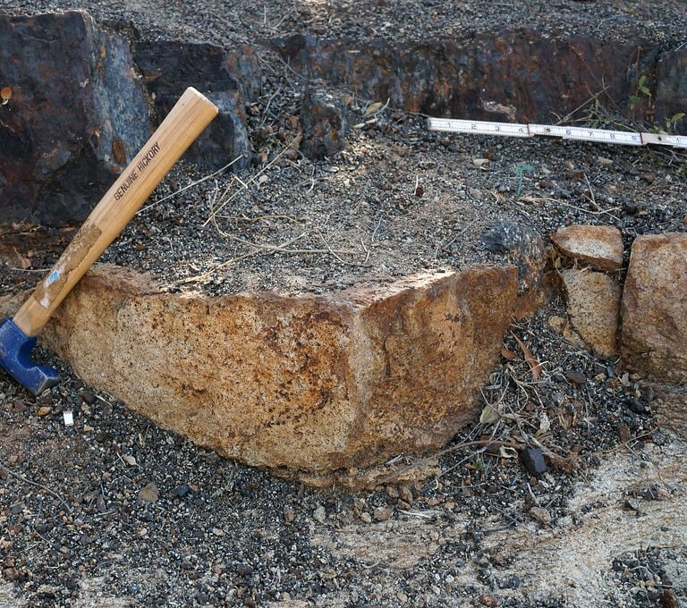
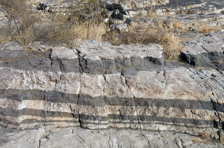
The Onverwacht Pipe
The Onverwacht Pipe lies in the eastern limb of the Bushveld Complex and is one of the most famous platinum-bearing ultramafic pipes in the world. It cuts across the layered rocks of the Lower Critical Zone, specifically between the LG6 and MG1 chromitite layers, slicing discordantly through what were originally flat-lying cumulates. In simple terms, rather than following the existing layering, the pipe punches through it.
The body itself is large, more than 300 metres in diamete, and has a distinctive “pipe-in-pipe” structure. Around the outside is a broad zone of magnesium-rich dunite (with olivine compositions around Fo80–83). At its centre sits a narrower, carrot-shaped core of iron-rich dunite pegmatite (Fo46–62), roughly 18 metres across. This central core is where the highest concentrations of platinum-group minerals occur, making it the economic heart of the pipe.
Geologically, the pipe intrudes layered feldspathic orthopyroxenites of the Lower Critical Zone, and fragments of chromitite—probably derived from the LG6 seam—are found enclosed within it. These fragments provide clear evidence that the pipe disrupted and incorporated pieces of the surrounding layered sequence as it formed.
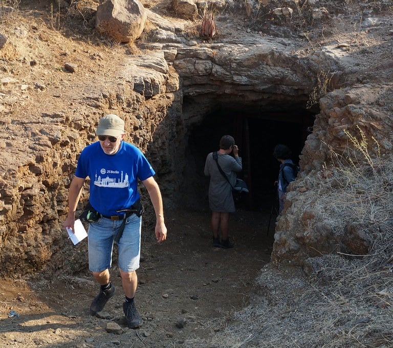
Historically, the Onverwacht Pipe was the site of the first primary platinum mine in South Africa and is regarded as a national monument. The ore is notably high-grade, containing platinum–iron alloys, sperrylite, and other platinum-group minerals. Its formation is generally interpreted as the result of late-stage, high-temperature magmatic fluids and melts forcing their way upward to form a steep, discordant pipe, rather than by the more typical process of sulphide saturation that explains many other platinum deposits.
Because of its size, grade, structure, and clear cross-cutting relationships, the Onverwacht Pipe is widely considered one of the premier examples of a mineralised discordant pipe within the Bushveld Igneous Complex, offering important insights into how platinum-rich magmatic systems can evolve late in the history of a large layered intrusion.
The Glory Hole at Onverwacht Pipe in the Bushveld Complex
The Onverwacht Pipe also contains significant chromite, occurring as xenoliths, disseminated grains and massive lumps within the pipe's structure. The chromite is believed to be derived from, or represents xenoliths of, the LG6 and MG4 chromitite layers, which were disrupted during the emplacement of the pipes. It is considered a consanguineous component of the pipe magma, having crystallized in situ simultaneously with olivine. It is often found in the iron-rich dunite core and as clusters or streaks in the magnesian dunite. The chromitite xenoliths within the pipes are highly mineralized, with platinum-group minerals (PGMs) often associated with these chromite-rich sections.
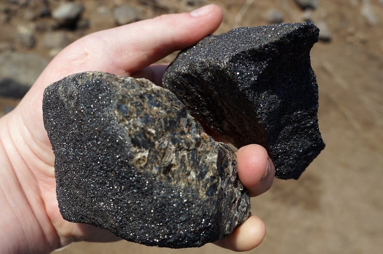
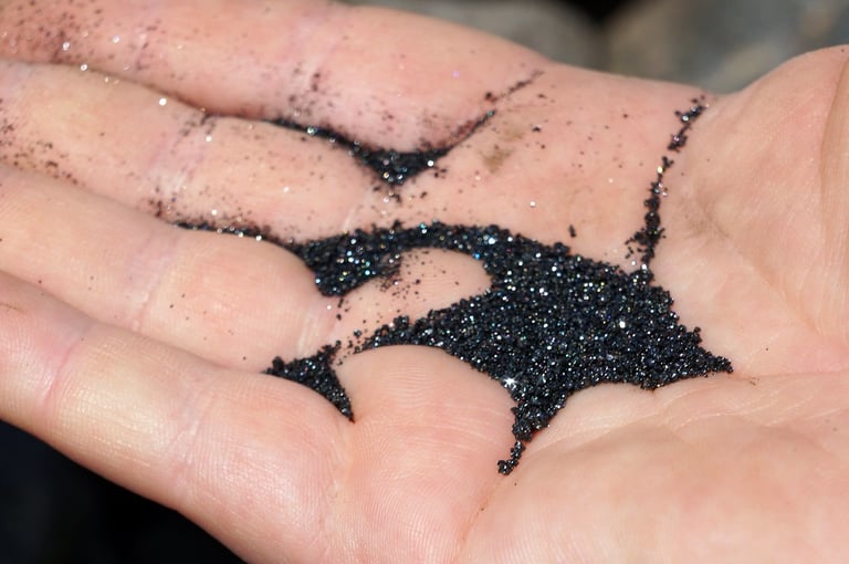
Chromite xenoliths and chromite sand from the Onverwacht Pipe
The Merensky Reef of the Bushveld Complex
The Merensky Reef, discovered in 1924, is a remarkably thin yet laterally extensive layer within South Africa’s Bushveld Complex. Despite often being less than a metre thick, it contains one of the largest concentrations of platinum-group elements (PGEs) on Earth. It lies in the upper part of the Critical Zone of the Rustenburg Layered Suite and has been the backbone of South Africa’s platinum industry for nearly a century.
Geographically, the reef extends across the Western, Eastern, and Northern limbs of the Bushveld Complex; in the Northern Limb, it is known as the Flatreef. Its continuity is extraordinary, stretching for more than 250 kilometres (about 155 miles), although it is locally disrupted by irregular depressions in the underlying rocks known as “potholes,” which can complicate mining.
Geologically, the Merensky Reef is what geologists call a reef-type deposit: a thin, tabular layer that can be traced over vast distances. It is typically associated with a pegmatoidal pyroxenite and is often bounded above and below by thin chromitite layers. The mineralisation consists mainly of platinum- and palladium-bearing sulphides such as braggite and cooperite, along with tellurides and platinum–iron alloys. These minerals are commonly associated with nickel–copper sulphides, and the reef is frequently mined together with the underlying UG2 chromitite, another major PGE-bearing horizon.
The formation of the Merensky Reef is widely linked to processes within the magma chamber, particularly the mixing of different magmas. This mixing is thought to have triggered the crystallisation and settling of dense minerals such as chromite and sulphides, concentrating platinum-group elements into a narrow but persistent layer.
Together with the UG2, the Merensky Reef makes the Bushveld Complex the world’s most important source of platinum and related precious metals, and it remains one of the best-studied examples of how large layered intrusions can generate exceptionally rich and laterally continuous mineral deposits.
The Merensky Reef, one of the world's largest platinum-group element (PGE) resources located in the Upper Critical ZOne of the Bushveld Complex
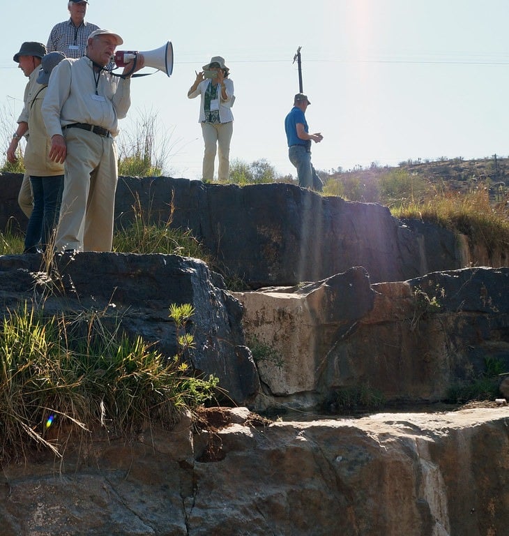
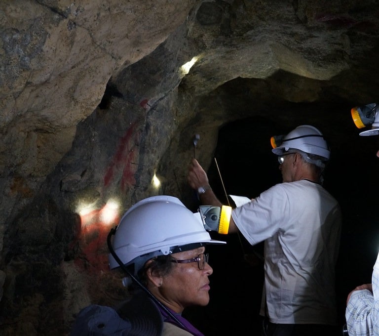
After a visit down the mine, we were given a chance to have a look at the upper Critical Zone core in the yard at the Marula Platinum Mine with mine geologist Jacolene describing the layering.
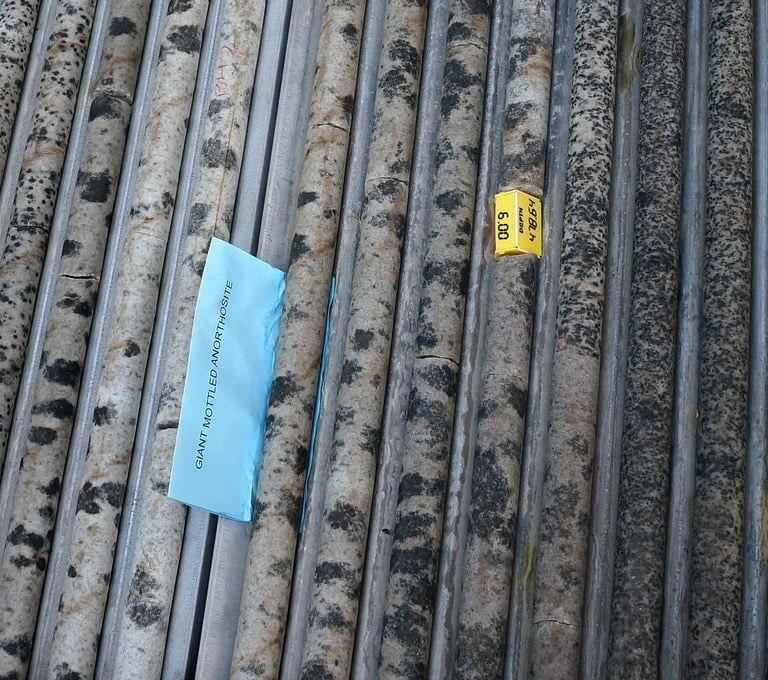
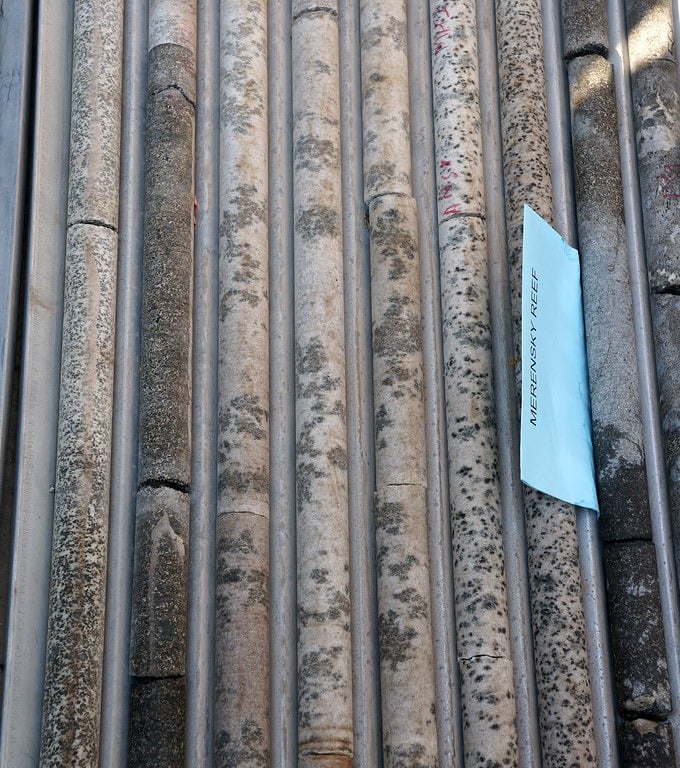
Drillcore of giant mottled anorthosite and Merensky Reef at the Marula Platinum Mine
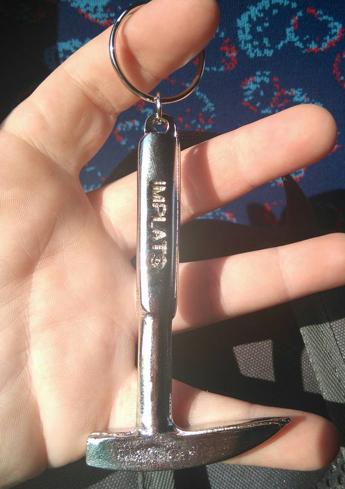
When we were at the Marula Mine, they gave us all these super duper cool key chains which I absolutely treasured for many years. Though unfortunately and very sadly, it came off my keychain one day, never to be seen again. I miss that miniature geological hammer every day!

Mpumalanga Drakensberg Escarpment
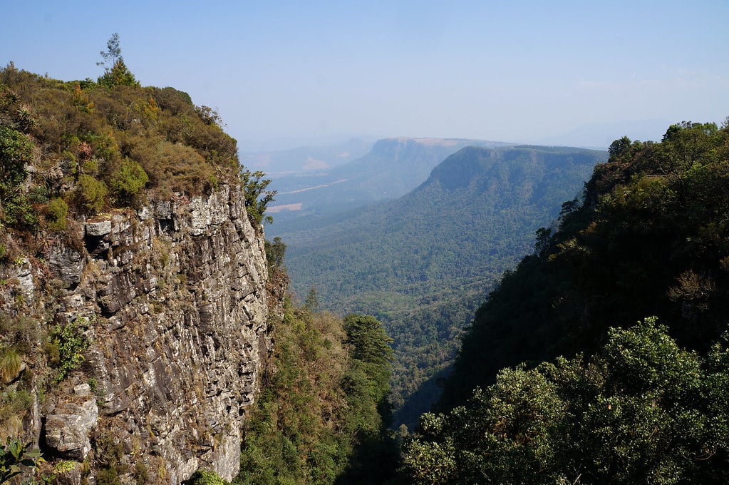
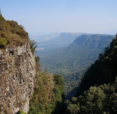
Blyde River Canyon
The Mpumalanga Drakensberg Escarpment is a dramatic, high-altitude mountain range forming the eastern edge of South Africa's plateau, connecting to the greater Drakensberg system. Known for the spectacular Blyde River Canyon and the Panorama Route, this region features rugged quartzite cliffs, panoramic views like the Three Rondavels and God's Window, and historical sites such as Pilgrim's Rest. It is characterized by hard, erosion-resistant, flat-lying quartzite (Black Reef Formation), creating high, steep-sided cliffs. There are several spectacular viewpoints as you drive along Blyde River Canyon.
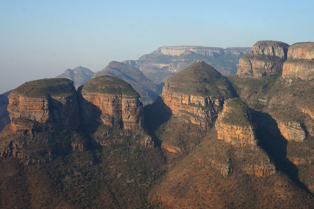
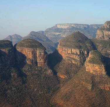
The Three Rondavels of Blyde River Canyon
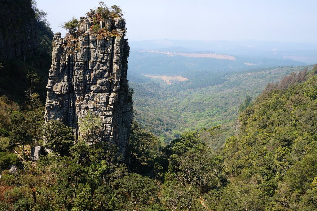
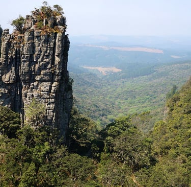
The Pinnacle of Blyde River Canyon
God's Window Blyde River Canyon
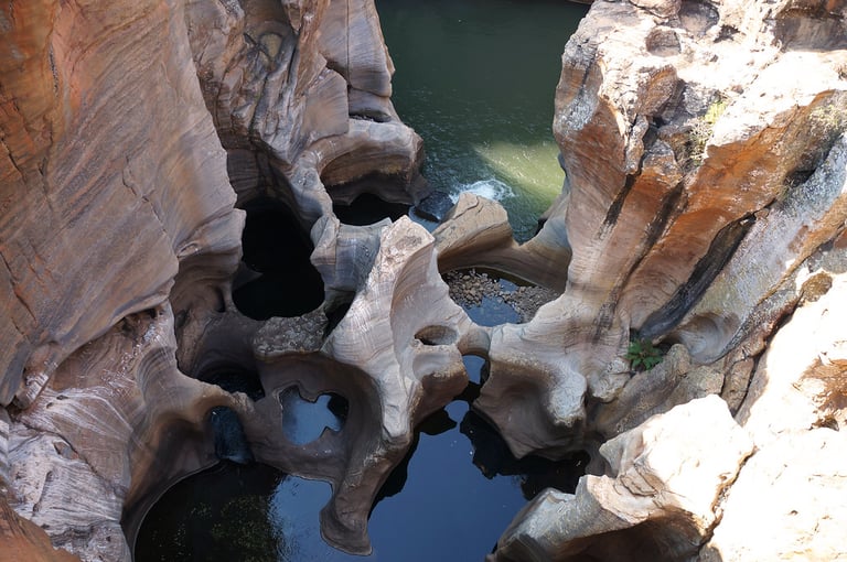
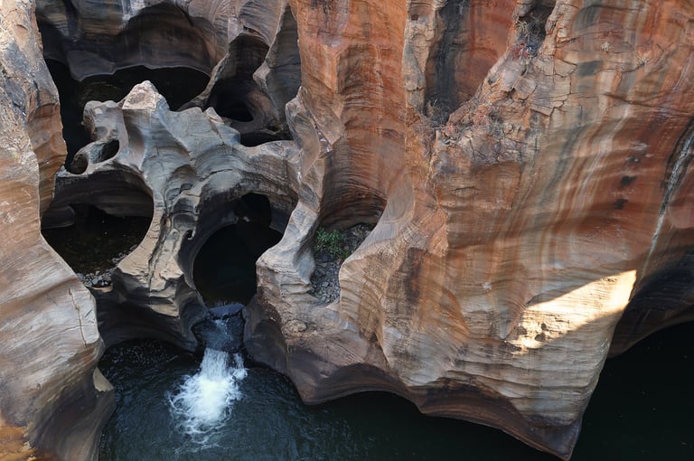
Bourke's Luck Potholes
Bourke's Luck Potholes, named after the gold prospector Tom Bourke, was another stop in the area of the Mpumalanga Drakensberg Escarpment. The potholes are a spectacular natural water feature, located at the confluence of the Blyde and Treur Rivers. Formed over millions of years by water erosion, these cylindrical, orange and red rock sculptures were created by swirling whirlpools and sandy water working its way through the resistant quartzite over millions of years.
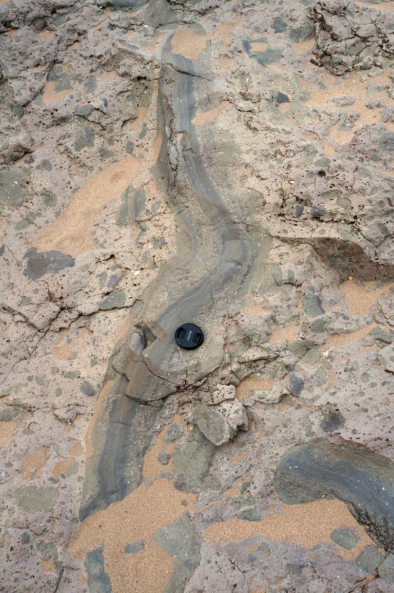
Sabie River Migmatite in Kruger National Park
We stopped next to Sabie River to examine some potassic granite migmatites that area common sight in the river valleys of Southern Kruger. The basement gneiss in this region is often intensely migmatised, characterized by banded, folded and often chaotic mixtures of leucosome (light-colored, melted, quartzo-feldspathic) and melanosome (dark, unmelted, biotite/amphibolite) components. These migmatitic gneisses are commonly tonalitic, featuring plagioclase, quartz, and biotite.
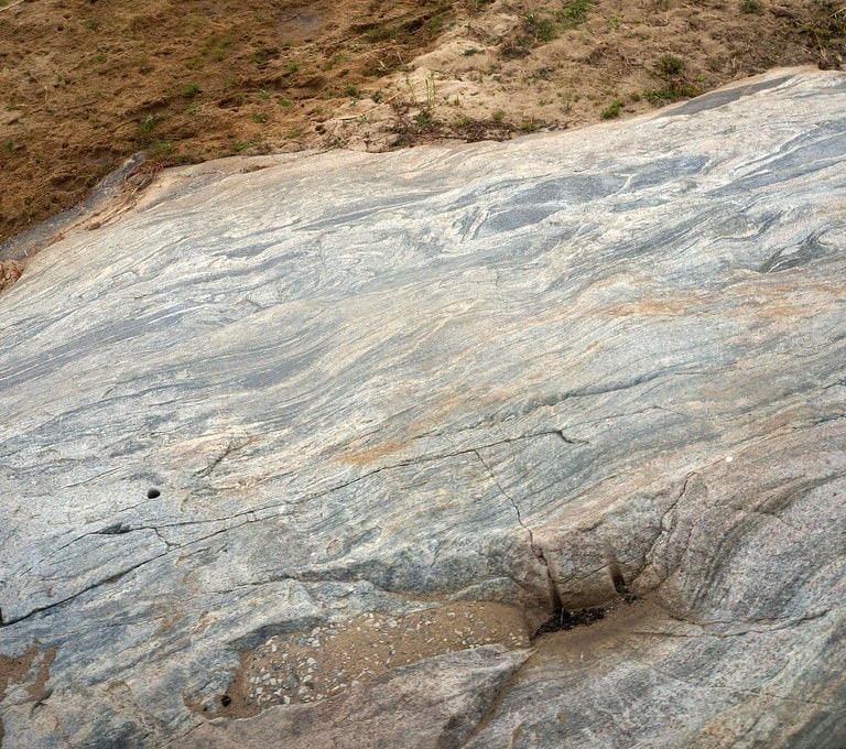
Potassic granite migmatites by River Sabie
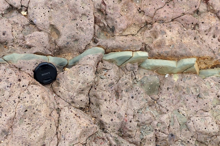
Karoo Basalts
The Karoo basalts are part of the Karoo Supergroup, an expansive sequence of sedimentary and igneous rocks covering two-thirds of Southern Africa. It records nearly continuous Gondwana sedimentation from glacial to arid environments. It is renowned for rich Permian-Triassic vertebrate fossils, including early dinosaurs and spans the Dwyka, Ecca, Beaufort and Stormberg groups. The lowest layer of the Karoo Supergroup is called Dwyka Tillite. Tillite is a motley collection of debris that is left behind when a glacier melts. This means that South Africa was once as cold as Scotland on a winter’s day and covered in thick glaciers.
Karoo basaltic lava plains underlie much of eastern Kruger and are overlain by rhyolite, the latter forming the Lebombo range along the Mozambique border. We saw lots of different volcanic formations, including volcanic bombs, seen here slightly greenish in light coloured tuffaceous matrix. We also saw dolerite dyke swarms (with one felsic dyke) dipping steeply westward and intrusive into the sequence of lava flows. The dykes, which represent feeders to the overlying flows, are the first manifestation of the split of the Gondwana continent and formation of the proto-Indian Ocean. Gondwana began breaking up during the Early Jurassic period (approximately 180 million years ago). The process occurred in stages, with the western half (Africa/South America) separating from the eastern half (Antarctica/India/Australia/Madagascar). We also saw the extrusive lavas themselves, but the flows are comprised of massive, dark, lower portions and light coloured amygdaloidal upper parts.
The many forms of both intrusive and extrusive igneous rocks we saw from the Karoo Supergrup during our travels through Kruger National Park.
Wildlife Viewing in Kruger National Park
I had never been on a safari prior to going to Kruger NP, so I can't perhaps compare experience. What I can say though that the wildlife viewing we experienced in Kruger NP in September 2016 was absolutely outstanding, and went way beyond my expectations as to how many animals we actually saw and I genuinely don't believe it can get much better than this.
One of the reasons I had never been on a safari before was because most African countries charge an absurd amount for the safaris themselves and same for the accommodation, making it completely unaffordable for most people, at least not without a serious monetary sacrifice. Kruger NP on the other hand is nothing like that. The entry fees are not expensive at all, the accommodation within the park is reasonably priced and you can self-drive through the park. There is genuinely no need to go on a jeep safari - you are as likely to see an elephant, a lion, a giraffe or a rhino as you drive along the main "highway" as seing sheep in Scotland. I am not joking. You CAN go on a jeep safari from your accommodation if you want, and they don't tend to be expensive either, but really, I didn't feel like there was any need.
The photos that follow are ones I took from our tour bus that only travelled on the main roads. I also didn't use a fancy camera with a fancy zoomlens or anything.
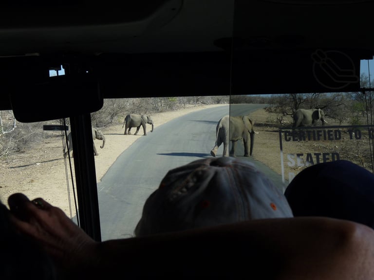
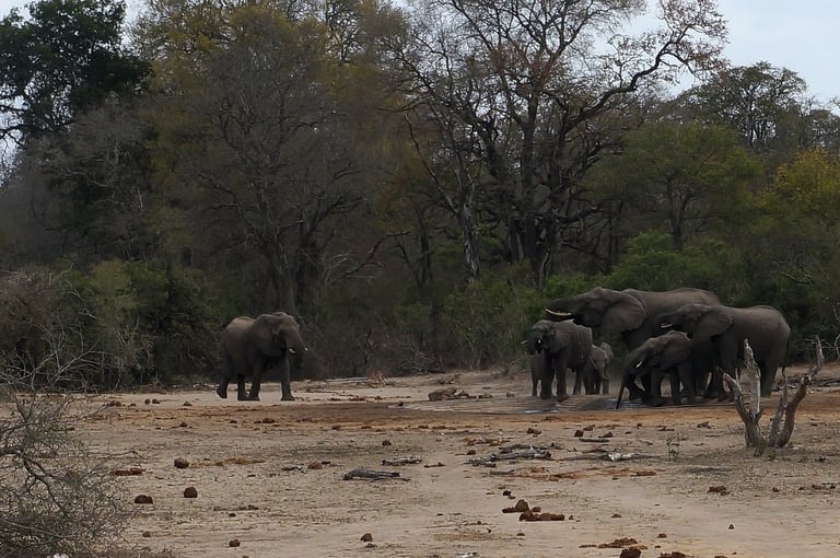
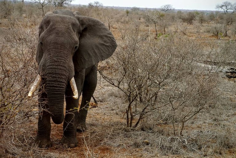
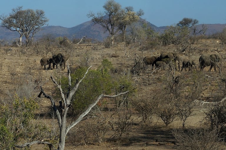
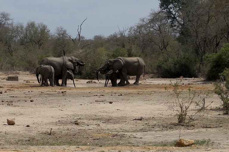
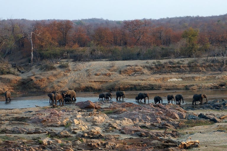
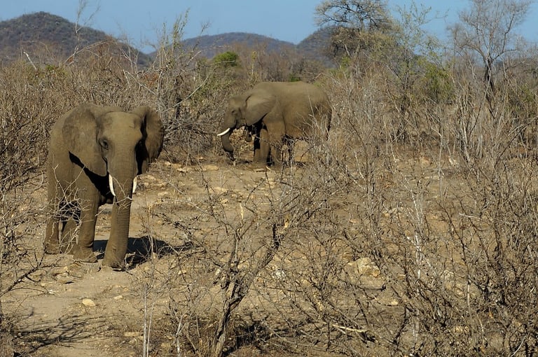
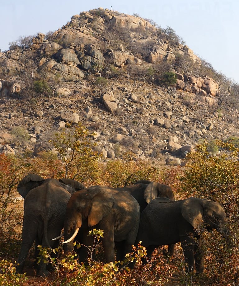
Elephants were very common across all the areas we passedthrough in Kruger.
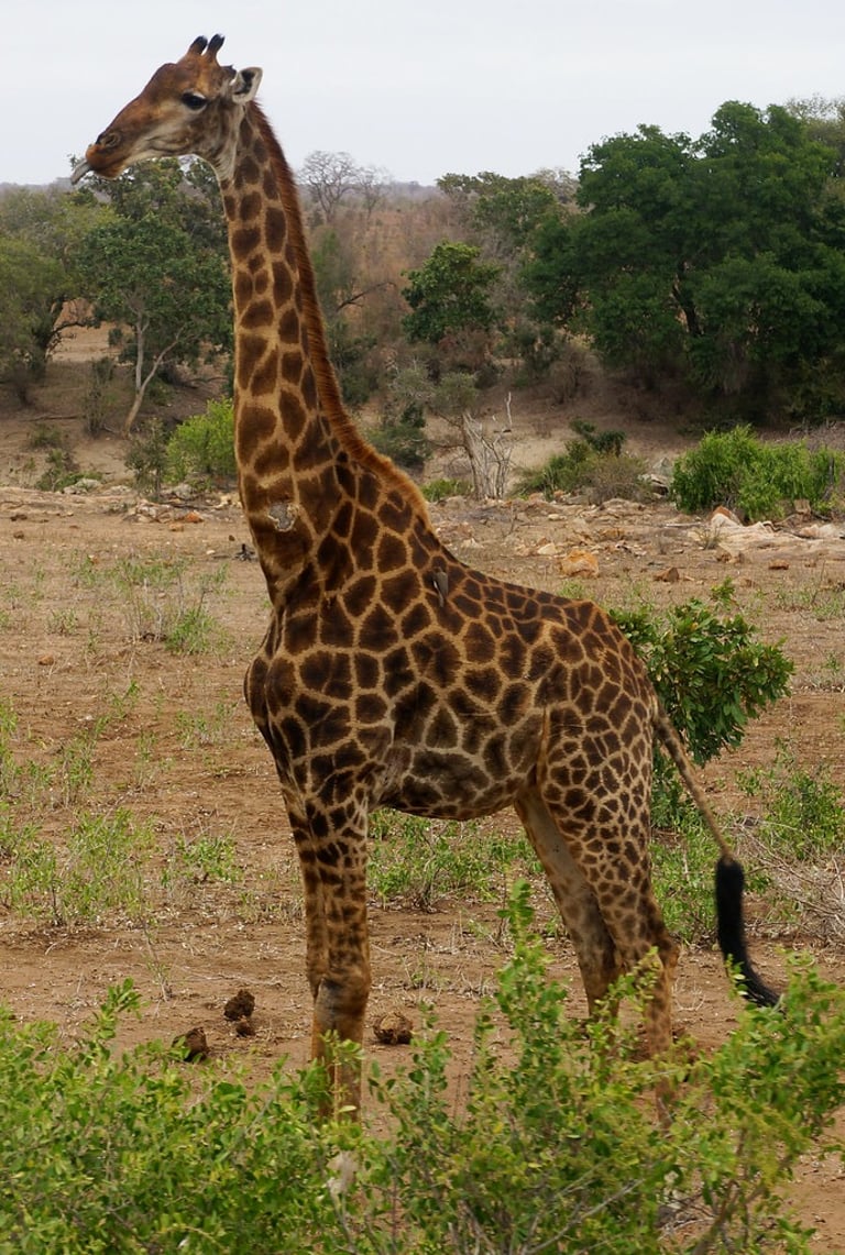
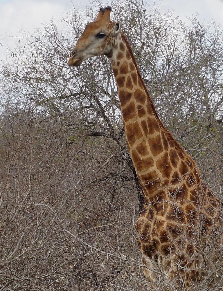
While giraffes weren't quite as frequently seen as elephants, we saw quite a few of them.
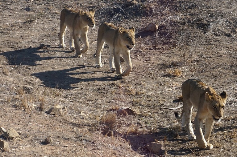
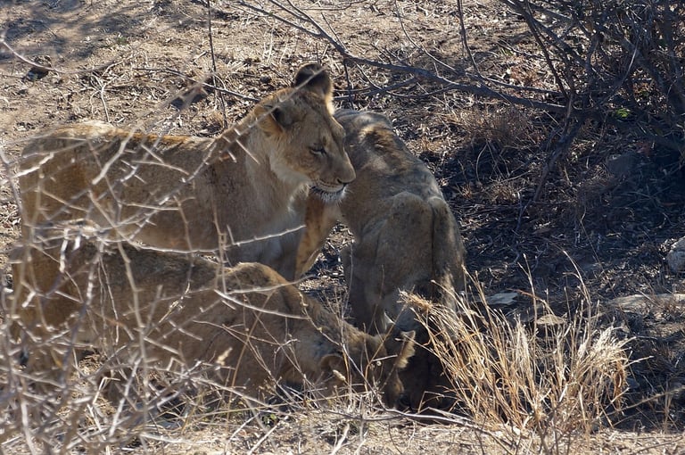
Lions were very common across the park, but I just took pictures of those close enough to get a good close-up photos.
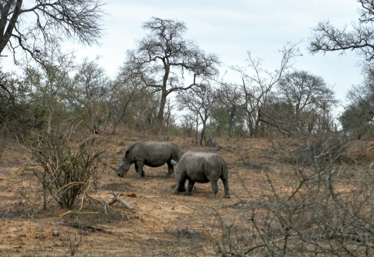
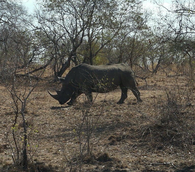
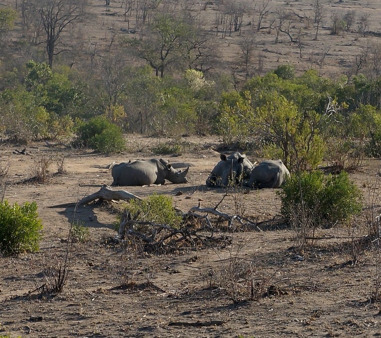
Rhinos were not too common to see, however I was very surprised to see as many as we did by the roadside!
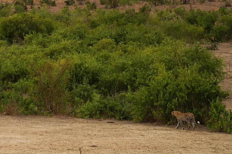
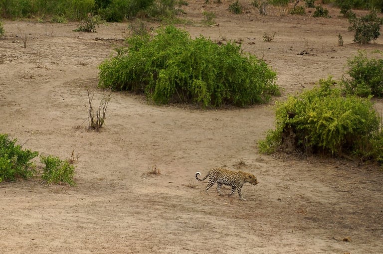
We saw two leopards, which apparently are extremely rare to see. My friend's husband who's South African couldn't believe my luck!
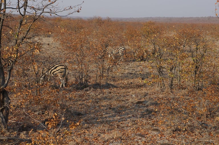
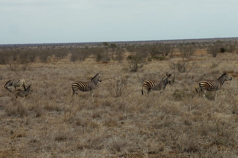
We saw lots of Zebras, even baby ones! So cute.
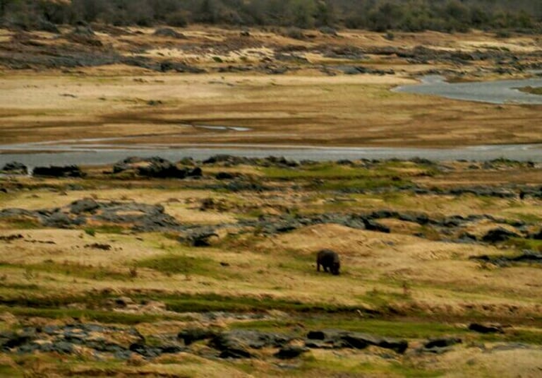
We did see some hippos, but they are obviously restricted to staying near water, so getting close-ups wasn't too easy. From memory, I think the first one was from one of our restcamps, maybe Sabie? Though I am not sure.
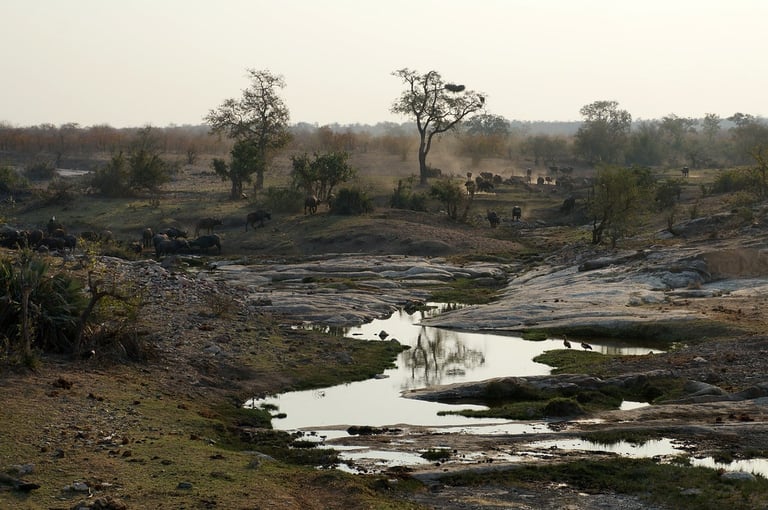
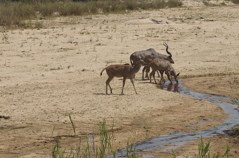
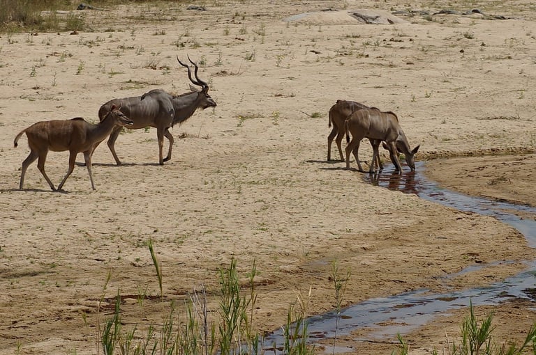
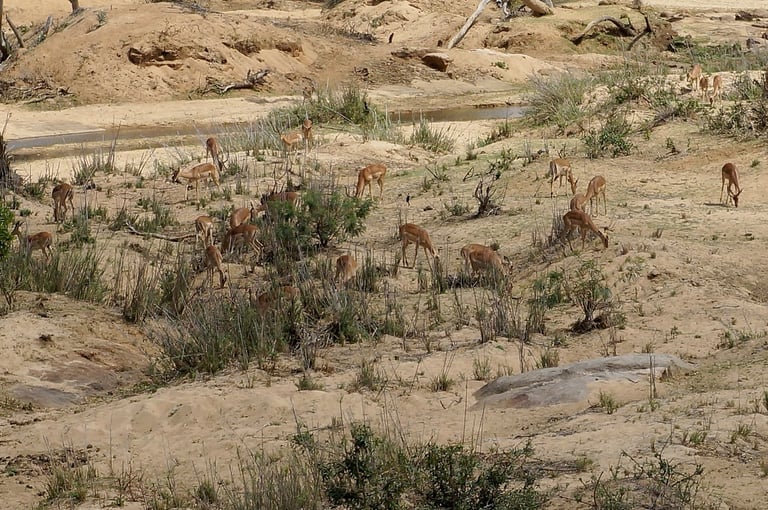
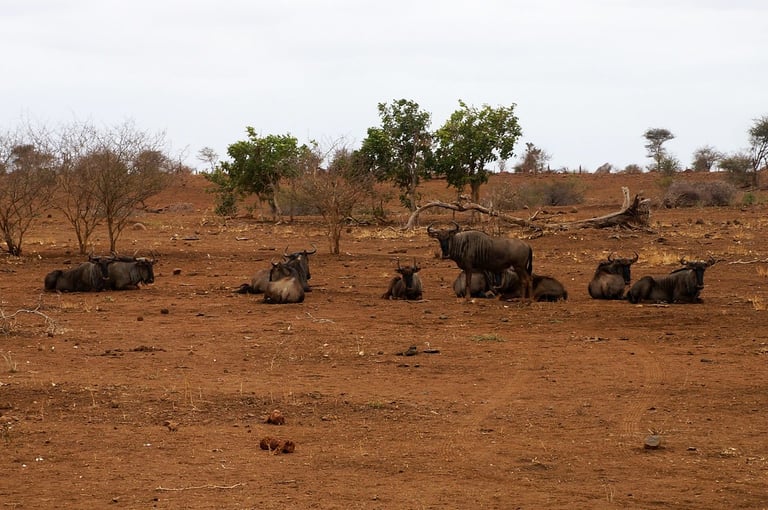
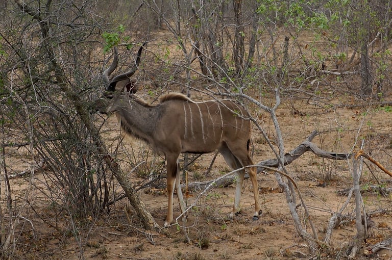
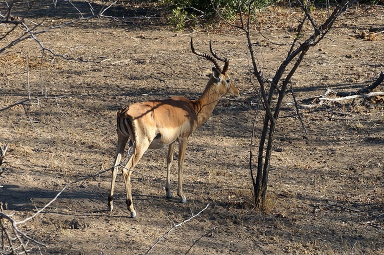
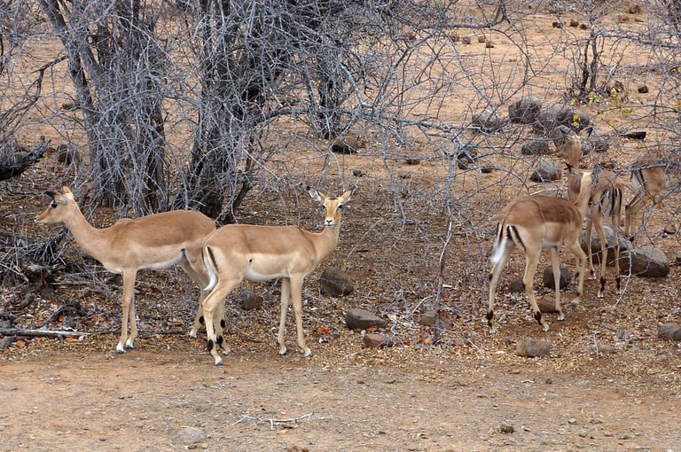
We saw loads and loaaaads of wildebeest, kudus, impalas and antelopes.
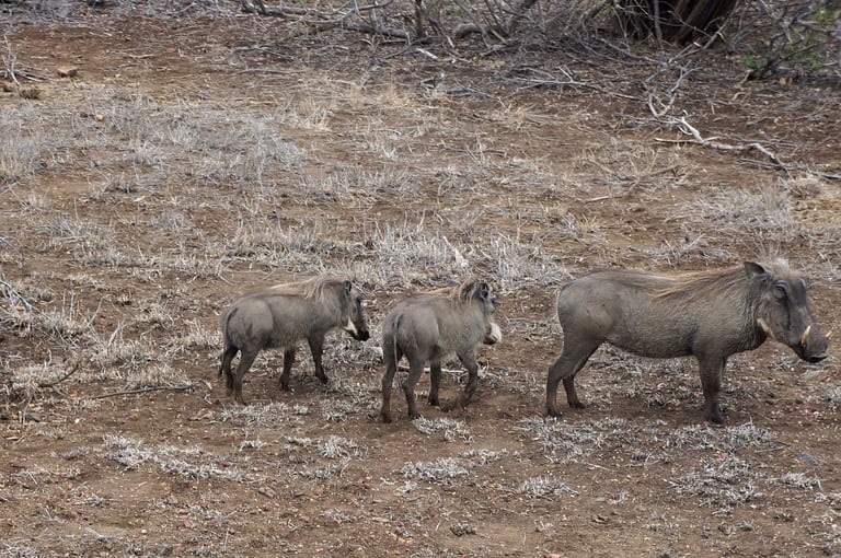
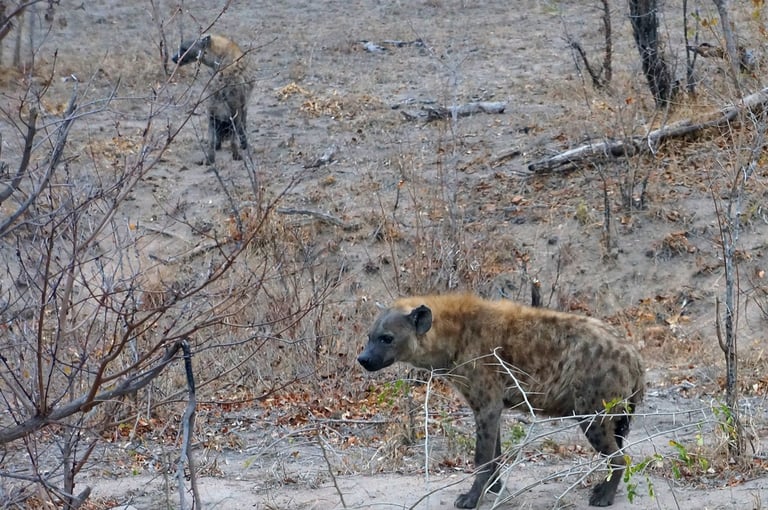
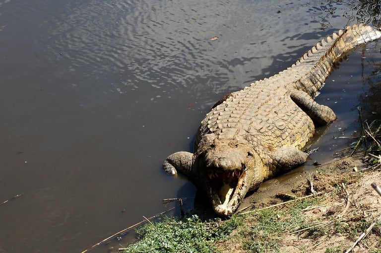
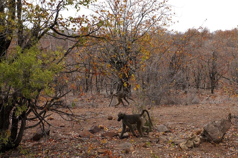
And finally, we also had some sightings of warthogs, Nile crocodiles, hyenas and baboons!
Follow us on Social Media for travel updates and top tips!
© 2026. All rights reserved.
I can't recommend Pimsleur enough for learning a new language! If you don't believe me, try for your self - All Access FREE for 7 days on signup.