Itinerary for an Iceland Ring Road trip (9-10 days)
This post is an adaptation of an email I sent to a colleague who was going to Iceland and was going to be travelling around in a campervan with his family. The itinerary focuses on the natural wonders of the country and gives you an idea of time scales how long it would take to travel around the full ring road. I would suggest 10 days, but in can be done in a week, but would just be very rushed. Take your time and enjoy the ride.
TRAVELICELANDEUROPE
The below itinerary and recommendations are for people going in a campervan around Iceland and have a particular interest in nature and geology. It also assumes you're going during the spring/summer/autumn time when places are accessible and it is safe to drive the full ring-road around Iceland (which this itinerary suggests).
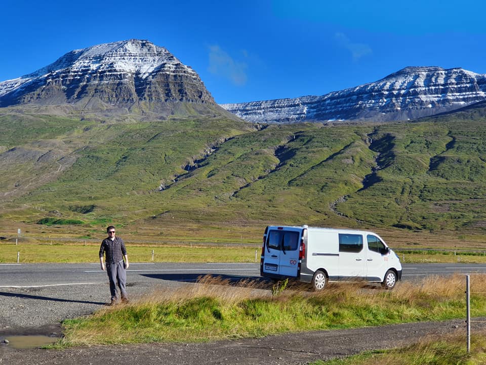
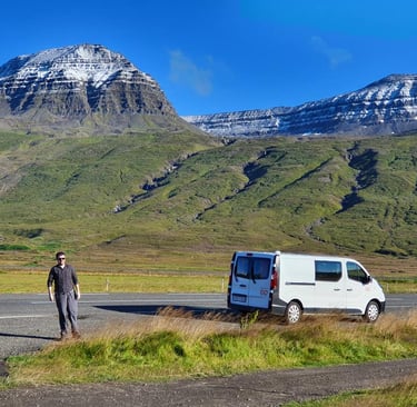
Campervaning, in my opinion, is the very best way to get around Iceland. It gives you so much freedom! Personally I would avoid booking campsites in advance but rather just rock up at the campsite the end of the day, as I’d say in 99 out of 100 cases there will be spaces available. We generally don’t book campsites in Iceland as we are fair-weather travellers (our way is to choose our destination based on the short-term weather forecast), as there are few things more miserable than camping in bad weather in Iceland. However, if you feel very nervous about being spontaneous and living by the Icelandic motto "Þetta Reddast" (a sort of an Icelandic version of Hakuna Matata - things have a way of working themselves out), you can always drop the campsite you think you'll end up staying at an email or give them a quick call to check if they think there’s any likelihood of them selling out (which is extremely rare). That way, if the weather turns bad you have a bit more flexibility rather than booking things ahead. Especially as there are areas you really shouldn’t travel through if the wind picks up a lot. Two particularly bad zones are the sands along Route 1 around Vatnajokull glacier (though this is getting substantially better due to lupin spreading so the sand doesn’t get blown as easily), as well as the higher elevations along the route between Egilsstadir and Myvatn, where you can have risk of flying pebbles in high winds, so better stay put until storm has calmed (if you encounter such a storm).
However, if you're more the hotel kind of person, just hiring a car is always an option. What I would just say though is that make sure you go with a reputable company (check their ratings on Google or whichever rental car comparison you decide to use). Some of the Icelandic agencies are dubious at best.... I would also recommend getting a car hire excess insurance. If you're in the UK like we are, we have used ReduceMyExcess numerous times in different countries, where on one occasion I scraped the front bumper of the car on an exceptionally high speedbump in Reykjavik, and fortunately for me, the excess insurance paid out quickly. So from personal experience, I'd recommend ReduceMyExcess.
Day 1: Þingvellir National Park, Laugarvatn Fontana + Geothermal Bread experience (best book ahead) – Geysir – Gullfoss. Then depending on how long you got left of the day (or energy) you could stay in the Faxi campsite (next to the Faxi waterfall on the Golden Circle) or in Selfoss which is the biggest town of South Iceland and good place to stock up on supplies as it will be your last cheap supermarket (Krónan and Bónus) and last big alcohol store for a while (there’s state monopoly on alcohol in Iceland, you can only buy it in the Vinbudin stores and they close usually at 6pm or earlier and closed Sundays). There are also a few restaurants in Selfoss, though the selection isn’t great. Though the hotdog wagon (Pylsuvagninn) next to the bridge by the river sells THE best hotdogs in Iceland! I never go to Iceland without having a hotdog there on my way to my parents’ in Hella.
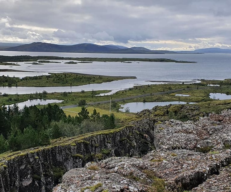
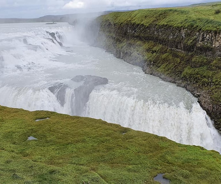
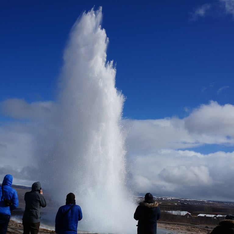
The Golden Circle in Iceland, from left: Þingvellir, Gullfoss, Geysir
Day 2 (or Day 2 and 3 if visiting Vestmannaeyjar): On your way east from Selfoss you’d typically stop at Seljalandsfoss to go behind the waterfall and also see the one hidden inside the mountain in the same place. Here, you are at the base of the Eyjafjallajokull volcano and if it’s a clear day you’ll see it towering the landscape as you move east from Hella. To the left of it will be Tindfjallajokull glacier (lots of smaller snowy peaks) and another bigger and flat one called Myrdalsjokull and inside if it is the massive ice-filled caldera of Katla volcano. In Hella (my hometown) there is a very worthwhile stop called The Caves of Hella. These are series of ancient caves likely pre-dating the Viking era which are thought to have been dug into the hillsite of the river valley by Irish monks. There's some stellar geology to be seen in the sedimentary rock there too. You're best to book ahead, to avoid disappointment. The swimming pool in Hella is also excellent, including water slides for the kids, several jacuzzis and sauna.
If you plan to go to Vestmannaeyjar islands, you’d usually take the ferry from just before Seljalandsfoss from Landeyjahofn harbour. It’s a small place so you can walk everywhere on the island easily. You can do it as a daytour coming back to your camper at the harbour (ferry schedule https://herjolfur.is/en/schedule ). If you skip Vestmannaeyjar then you’d head straight to Seljalandsfoss waterfall. As you drive further along Route 1 you’ll be driving along impressive cliffs with small waterfalls falling down the cliff all over the place. This is an old sea cliff from when the sealevel was higher and you’re essentially driving on a former seabed. The next stop would be Skogafoss waterfall which is really impressive and there’s a campsite there too (again, easy enough just to rock up, there’s more than enough campsites in Iceland), in the event you’re short on time as you’ve just been to Vestmannaeyjar for much of your day. Many people enjoy the folk museum in Skogar, too. If you’re continuing along, the next stop is then the Solheimajokull glacier, an outlet glacier of Myrdalsjokull which is disappearing at an alarming rate. There are glacier hiking tours there, but I’d say the ones in Skaftafell are better. After Skogar you’d go towards Vik village but before you get there, you should turn right onto Route 218 towards Kirkjufjara beach and Dyrholaey. Puffins are often seen at Dyrholaey and if you go to the lighthouse at the top, there are superb views! Especially on a clear day. Then you go back up to Route 1 heading east and again turn right onto Route 215 this time towards Reynisfjara beach where you see the stunning basalt columns, black pebble beach and puffins. Just be very careful not to get to close to the sea as sneaker waves are incredibly common, incredibly dangerous and have taken numerous lives. Then you go back up to Route 1 and head to Vik village. They have a good campsite there if you’ve had enough travels for the day and some good restaurants – we like the Smidjan Brugghus brewery & gastropub. The village is in a beautiful setting as well. The main sights in Vik is the village beach, the sea stacks looking west of the village from the beach (Reynisdranar) and the Lava Show.
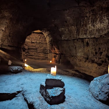
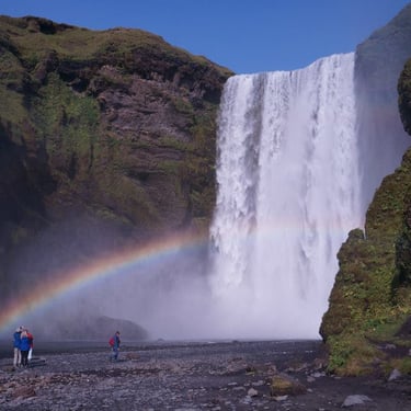
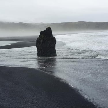
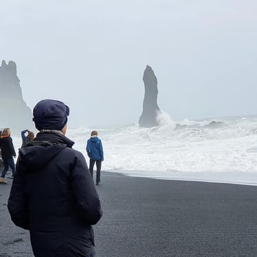
South Coast of Iceland, from left: Caves of Hella, Skogafoss, Kirkjufjara Beach near Vik, Reynisfjara beach near Vik
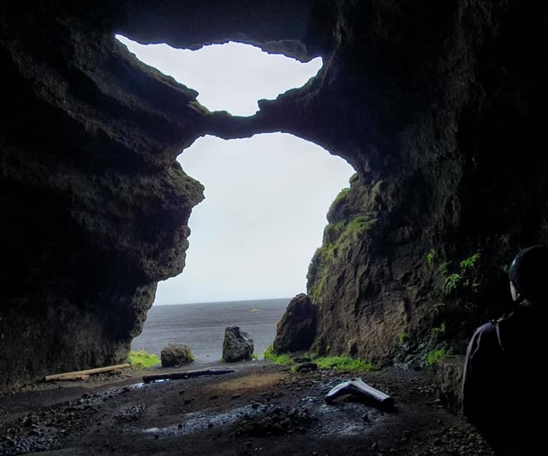
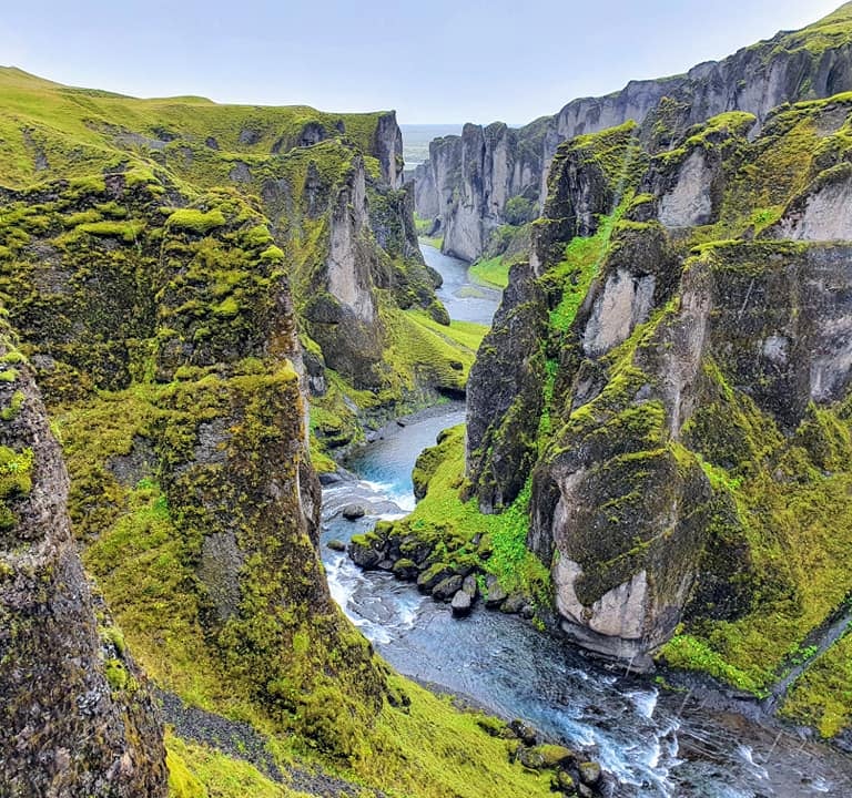
Day 3 and 4: The drive from Vik towards Skaftafell feels incredibly long and boring, driving over the sandy glacier outwash plains from previous floods from Katla volcano (when all the ice has melted inside the caldera). The worthwhile stops along the way include the short detour Hjorleifshofdi (which used to be an island when sealevel was higher) and within it, there’s a cave commonly called “Yoda Cave” as when you stand inside it looking out, it has the shape of Yoda. Then there’s Laufskalavarda cairns which is just an odd place with millions of small cairns on the left side of Route 1. Then you start driving across vast lava fields called Eldhraun from the famous Skaftáreldar (The Skaftá River Fires) in 1783 (https://icelandictimes.com/skaftareldar-disaster/ ). In that area there’s a left turn to go to Fjaðrárgljúfur canyon which is really worth it!! But just beware there might be A LOOOOOTTT of cars there parked, it’s often impossible to get parked unless you’re there very early in the day or very late in the day. You’ll then eventually get to the first sign of civilisation when you get to Kirkjubaejarklaustur which is good for a quick bite to eat, as well as to check out Kirkjugolf (“Church Floor”) which is a floor-like structure made up of basalt columns where the top has been wiped and polished, making it look like a tile floor almost. Then moving onwards to Skaftafell many people like a quick photoshop at Foss á Síðu and a quick detour to Núpsstaðakirkja church. As you go further east, you start seeing a really impressive prominent mountain sticking up from the plains (you’ll know it when you see it!) called Lómagnúpur. Theeeen you’re finally very very almost in Skaftafell haha. There are loads of hiking trails in Skaftafell and they’re all very pretty but the most popular one is to Svartifoss waterfall (waterfall falling off a basalt column cliff). The campsite in Skaftafell is excellent and there are good glacier hikes from there. Spending 2 nights in that campsite is a good idea, as there's plenty to see.
Day 5: After Skaftafell, the sights become sparser but scenery is still gorgeous as you drive through the Eastfjords. Here it’s more about the journey rather than the destination. Your first stop will be Jokulsarlon glacier lagoon. They have boat tours on the lagoon if that’s something you fancy but it’s not really needed as there’s usually plenty of icebergs around. It’s also nice to walk to the beach from the carpark as there are often icebergs sitting on the beach (called “Diamond Beach”). Many people then as they head further east stop at Mt. Vestrahorn. The farmer who owns the land is a bit bonkers and will chase you for money to park (as it’s his own private road and land), but the view is beautiful. Another nice pitstop is Lækjavik beach and a bit further along the Eastfjords is Blábjörg (“Blue Cliffs”) with greenish blue rocks (ignimbrite) by the beach, an intrusion and stunning views. After than, it’s mostly just stunning views along the road and little villages. What I would recommend if you have the time is to make a small detour off Route 1 to go to Hengifoss (a beautiful waterfall and a geologist’s wonderland!!) which includes a bit of a hike but so worth it! You can have food / coffee & cake at the Skriduklaustur café near there. Then a very nice way to end a long day with hiking and travelling is going to the Vok baths.
South Coast of Iceland, from left: Yoda Cave in Hjorleifshofdi, Fjadrargljufur Canyon
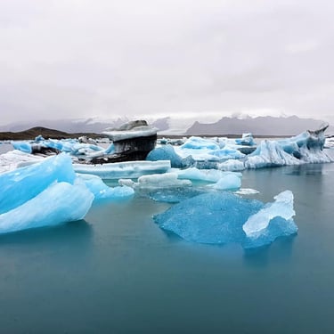
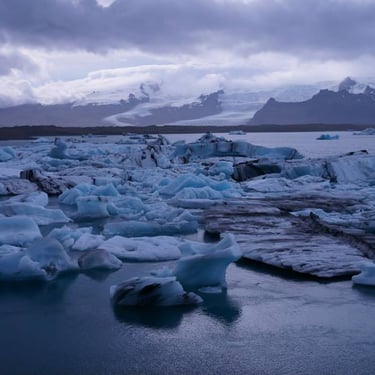
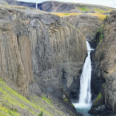
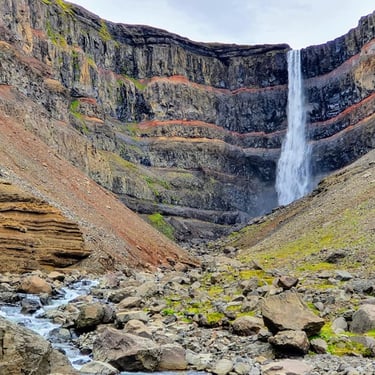
South and east Iceland, from left: Jokulsarlon x2, Litlanesfoss waterfall, Hengifoss waterfall
Day 6: Another hikers’ heaven in this neck of the woods is the area surrounding Bakkagerði village. The most popular hiking trail is to Stórurð https://www.wikiloc.com/hiking-trails/storurd-loop-trail-101364967 . Then in the village itself there’s the harbour Hafnarhólmi which is one of the best places in Iceland to see puffins if you're there at that time of year (you’ll be puffined out by this point!). I'd spend a full day in this region, because it's really so pretty and lots of walking opportunities.
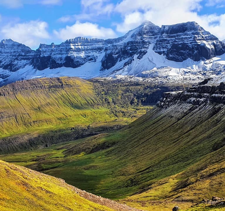
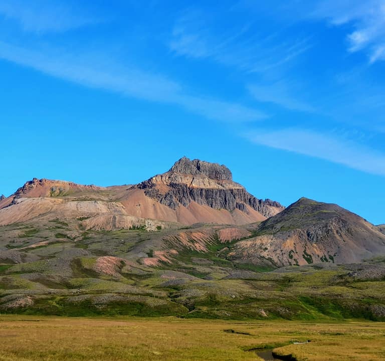
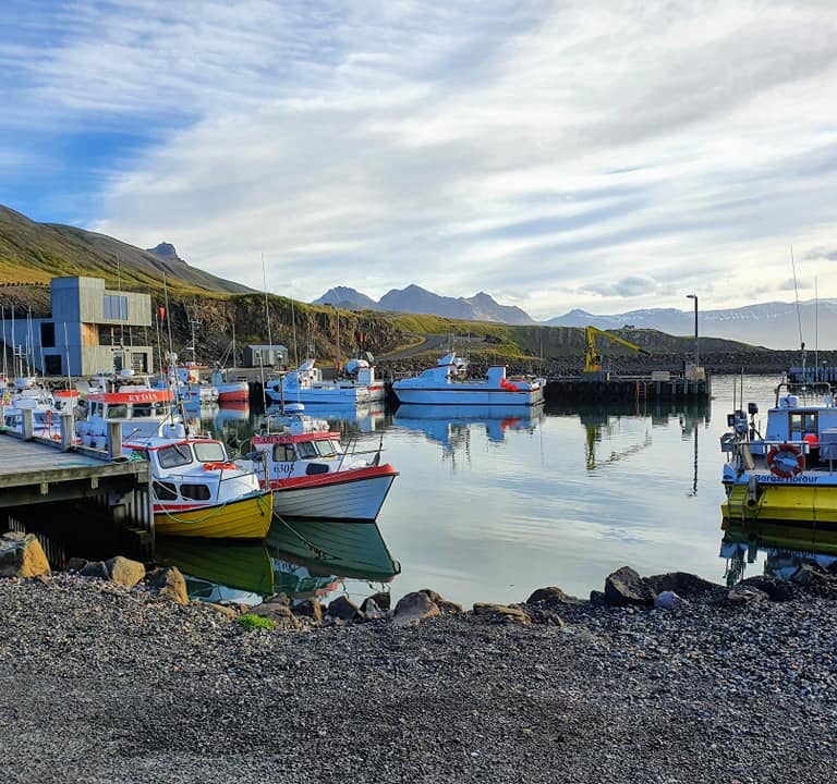
Bakkagerdi area in Eastern Iceland, from left: The trail to Storurd, view from Bakkagerdi village, the harbour in Bakkagerdi
Day 7: As you travel from Egilsstadir (or preferably Bakkagerði) towards Myvatn area, you can make a detour to trek to Stuðlagil which is a famous canyon filled with basalt columns on both sides https://www.alltrails.com/en-gb/trail/iceland/eastern/studlagil-canyon--2. After the canyon you would normally head to the Jökulsárgljúfur canyon national park to see Dettifoss waterfall (one of the biggest most powerful ones in all of Iceland). You can also opt to go further north along the canyon to hike to Hljóðaklettar and Rauðhólar https://www.alltrails.com/en-gb/trail/iceland/northeastern/raudholar-circle (again geologist’s wonderland). From there, going a bit further north is Ásbyrgi where there’s a nice campsite. This place is just so odd and has had Icelandic geologists scratching their head as to how it formed. It forms a horse shoe shaped vertical cliffs, you see it really well if you walk up to the top of the plain from the campsite. The myth says that Sleipnir the horse of Odin touched down with one leg haha. I really like staying in Ásbyrgi, it’s a good campsite.
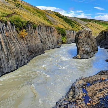
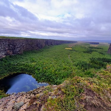
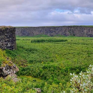
Northeast Iceland, from left: Studlagil canyon, Asbyrgi x2, Raudholar, Hljodaklettar
Day 8: Before you go to Iceland, YOU MUST (!!) watch the Eurovision Song Contest film with Will Ferrell!! Then after Ásbyrgi on your way to Myvatn area you can stop in Husavik village, made famous by the film! Some of the best whale watching also departs from there and there’s a really really really popular geothermal spa there called Geosea Geothermal Baths. From there, you’ll then drive south through Adaldalur valley where I did my fieldwork for my MSc thesis! (sampling water from hot & cold boreholes, surface waters and springs). In the Myvatn area the typical spots for stopping are Krafla, Leirhnjúkur, Hverir geothermal area in Namaskard, walk up Hverfjall crater, Grjótagjá, Dimmuborgir lava field, Skútustaðagígar pseudocraters and many opt for the “Blue Lagoon of the North” at Mývatn Nature Baths. If you like bird watching, Myvatn lake is an excellent place for that. As you travel west from Myvatn, there isn’t that much to see aside from Godafoss waterfall, which is stunning. Akureyri is a pleasant town to visit, the biggest one in the north and a good place for camping, but this is the one campsite you may have to call ahead just to make sure it's not full, especially if you're there on a weekend cause it's enormously popular with Icelandic families. North of Akureyri, there’s also the peculiar Bjórböðin beer baths (yes, you bathe in a tub of beer). If you get as far north as the beer baths, you may as well go around the peninsula to Siglufjordur which is a really pretty seaside town and stay there instead of Akureyri
Day 9: You go onwards to the west of the peninsula to Hofsós village to go to the public pool (Hofsós Sundlaug) there which has beauuuuutiful views over the bay. After this, there’s really not much to see – if you need to save time somewhere on your way around Iceland, the area between Hofsos and Reykjavik is the area to skip. If you do find yourself with some time at the end of the trip, you can check out Hvitserkur sea stack, Grábrók crater and then make a detour into the interior to see Vidgelmir cave, Hraunfossar waterfall, Barnafoss waterfall, Husafell Canyon Baths and/or Krauma geothermal baths as well as Deildartunguhver hot spring.
Once you get to Reykjavik, you probably don't want to be staying in a campervan. Any time we go to Iceland, we tend to alternate between our two favourite hotels: Reykjavik Residence (located in centre of town, to be avoided if it's the weekend unless you like late night parties) and Sif Apartments (far enough out of town to be quiet on weekends but close enough to walk to where all the action is). Note that the links are affiliate links, but clicking them will not include any additional cost to you, but will support the expense I have to keep the hosting and domain of this website running, so thank you if you use them.
My main recommendations really is to allow yourselves to be flexible, so not booking accommodation ahead of time, as you will want more time in some places, less time in others and sometimes the weather might get in the way where you’ll just want to stop and chill with a cuppa in your camper while you wait out a storm. There’s so much to see but you should have enough time. We did the circle in a campervan in 1 week and while a bit rushed, it was well possible. You also have the bonus of extra daylight in the summer (we were there in September so it got dark much earlier). I would recomment planning to spend most of your time on the South, Southeast and the Northeast. Reykjavik is pretty boring, if I’m being honest. I wouldn’t spend too much time there, nature is really where Iceland shines and you’ll find yourself wishing you had more time to explore all the beautiful places – where you can save time is by spending less time in Reykjavik. It’s the reason why most people come back and back and back again to Iceland because there’s just sooooo much to see!
You will probably find yourself coming back to see the interior, the Westfjords, Snaefellsnes Peninsula and Reykjanes peninsula, which has not been included in this itinerary, as it's a bit out of the way from the ring road.
Follow us on Social Media for travel updates and top tips!
© 2026. All rights reserved.
I can't recommend Pimsleur enough for learning a new language! If you don't believe me, try for your self - All Access FREE for 7 days on signup.